MPG Montagne des Peres, French Guyana - Earthquake Result Viewer
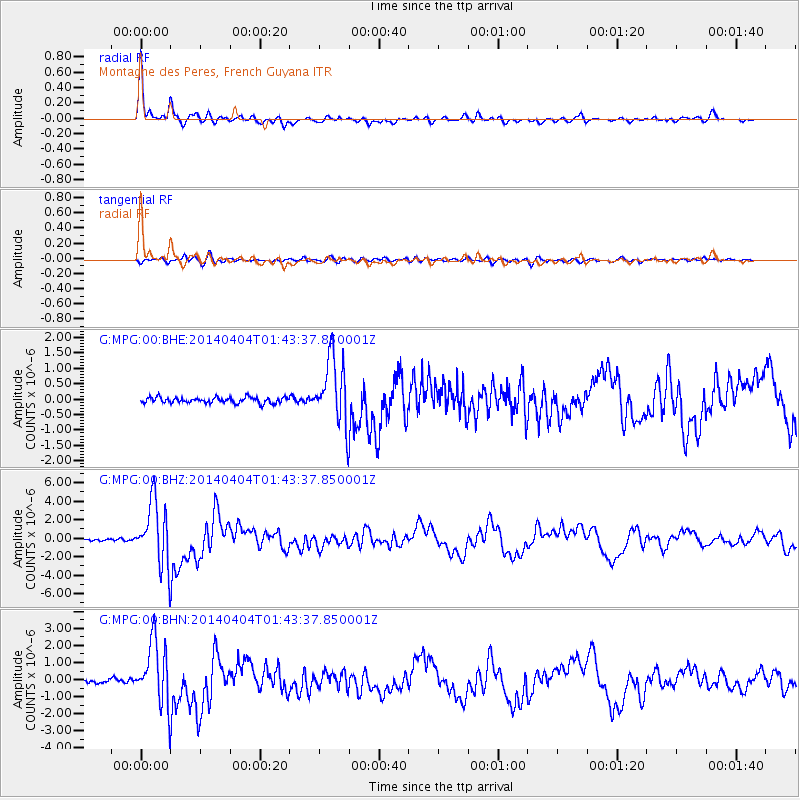
Earthquake location: Near Coast Of Northern Chile
Earthquake latitude/longitude: -20.6/-70.7
Earthquake time(UTC): 2014/04/04 (094) 01:37:51 GMT
Earthquake Depth: 20 km
Earthquake Magnitude: 6.1 MWP, 6.1 MWB, 6.1 MWW, 6.3 MWC
Earthquake Catalog/Contributor: NEIC PDE/NEIC COMCAT
Network: G GEOSCOPE
Station: MPG Montagne des Peres, French Guyana
Lat/Lon: 5.11 N/52.64 W
Elevation: 147 m
Distance: 31.1 deg
Az: 36.746 deg
Baz: 214.236 deg
Ray Param: 0.07913536
Estimated Moho Depth: 51.5 km
Estimated Crust Vp/Vs: 1.60
Assumed Crust Vp: 6.472 km/s
Estimated Crust Vs: 4.045 km/s
Estimated Crust Poisson's Ratio: 0.18
Radial Match: 95.42768 %
Radial Bump: 350
Transverse Match: 77.736084 %
Transverse Bump: 400
SOD ConfigId: 626651
Insert Time: 2014-04-22 09:35:55.782 +0000
GWidth: 2.5
Max Bumps: 400
Tol: 0.001

Signal To Noise

ChannelStoNSTALTA
G:MPG:00:BHZ:20140404T01:43:37.850001Z34.521733.4644404E-61.00355365E-7
G:MPG:00:BHN:20140404T01:43:37.850001Z19.523251.8689411E-69.572899E-8
G:MPG:00:BHE:20140404T01:43:37.850001Z11.61864951.0787589E-69.284719E-8
Arrivals
Ps5.2 SECOND
PpPs19 SECOND
PsPs/PpSs24 SECOND