You are here: Home > Network List > TA - USArray Transportable Network (new EarthScope stations) Stations List
> Station M51A Elyria, OH, USA > Earthquake Result Viewer
M51A Elyria, OH, USA - Earthquake Result Viewer

| Earthquake location: |
Near Coast Of Northern Chile |
| Earthquake latitude/longitude: |
-20.6/-70.7 |
| Earthquake time(UTC): |
2014/04/04 (094) 01:37:51 GMT |
| Earthquake Depth: |
20 km |
| Earthquake Magnitude: |
6.1 MWP, 6.1 MWB, 6.1 MWW, 6.3 MWC |
| Earthquake Catalog/Contributor: |
NEIC PDE/NEIC COMCAT |
|
| Network: |
TA USArray Transportable Network (new EarthScope stations) |
| Station: |
M51A Elyria, OH, USA |
| Lat/Lon: |
41.33 N/82.18 W |
| Elevation: |
239 m |
|
| Distance: |
62.5 deg |
| Az: |
350.306 deg |
| Baz: |
167.911 deg |
| Ray Param: |
0.06013315 |
| Estimated Moho Depth: |
36.5 km |
| Estimated Crust Vp/Vs: |
1.92 |
| Assumed Crust Vp: |
6.498 km/s |
| Estimated Crust Vs: |
3.38 km/s |
| Estimated Crust Poisson's Ratio: |
0.31 |
|
| Radial Match: |
82.53262 % |
| Radial Bump: |
400 |
| Transverse Match: |
72.94647 % |
| Transverse Bump: |
400 |
| SOD ConfigId: |
626651 |
| Insert Time: |
2014-04-22 09:58:30.896 +0000 |
| GWidth: |
2.5 |
| Max Bumps: |
400 |
| Tol: |
0.001 |
|
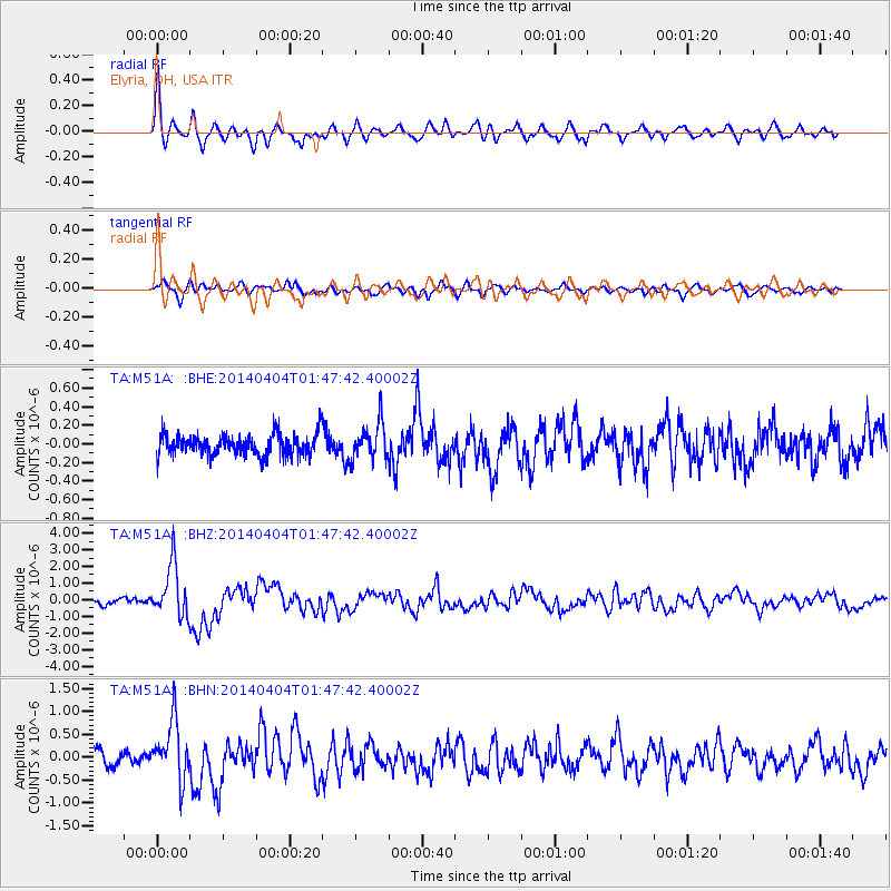
Signal To Noise
| Channel | StoN | STA | LTA |
| TA:M51A: :BHZ:20140404T01:47:42.40002Z | 9.011257 | 1.5577498E-6 | 1.7286709E-7 |
| TA:M51A: :BHN:20140404T01:47:42.40002Z | 4.0640116 | 6.365619E-7 | 1.5663387E-7 |
| TA:M51A: :BHE:20140404T01:47:42.40002Z | 1.7027835 | 1.9786961E-7 | 1.1620362E-7 |
| Arrivals |
| Ps | 5.4 SECOND |
| PpPs | 16 SECOND |
| PsPs/PpSs | 21 SECOND |


