You are here: Home > Network List > TA - USArray Transportable Network (new EarthScope stations) Stations List
> Station N47A Urbana, IN, USA > Earthquake Result Viewer
N47A Urbana, IN, USA - Earthquake Result Viewer

| Earthquake location: |
Near Coast Of Northern Chile |
| Earthquake latitude/longitude: |
-20.6/-70.7 |
| Earthquake time(UTC): |
2014/04/04 (094) 01:37:51 GMT |
| Earthquake Depth: |
20 km |
| Earthquake Magnitude: |
6.1 MWP, 6.1 MWB, 6.1 MWW, 6.3 MWC |
| Earthquake Catalog/Contributor: |
NEIC PDE/NEIC COMCAT |
|
| Network: |
TA USArray Transportable Network (new EarthScope stations) |
| Station: |
N47A Urbana, IN, USA |
| Lat/Lon: |
40.88 N/85.69 W |
| Elevation: |
252 m |
|
| Distance: |
62.7 deg |
| Az: |
347.285 deg |
| Baz: |
164.222 deg |
| Ray Param: |
0.060003195 |
| Estimated Moho Depth: |
32.25 km |
| Estimated Crust Vp/Vs: |
1.83 |
| Assumed Crust Vp: |
6.498 km/s |
| Estimated Crust Vs: |
3.56 km/s |
| Estimated Crust Poisson's Ratio: |
0.29 |
|
| Radial Match: |
86.754 % |
| Radial Bump: |
288 |
| Transverse Match: |
62.353836 % |
| Transverse Bump: |
400 |
| SOD ConfigId: |
626651 |
| Insert Time: |
2014-04-22 09:59:22.686 +0000 |
| GWidth: |
2.5 |
| Max Bumps: |
400 |
| Tol: |
0.001 |
|
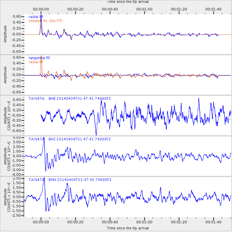
Signal To Noise
| Channel | StoN | STA | LTA |
| TA:N47A: :BHZ:20140404T01:47:43.749995Z | 13.254213 | 1.8756972E-6 | 1.4151705E-7 |
| TA:N47A: :BHN:20140404T01:47:43.749995Z | 7.8002257 | 1.0535813E-6 | 1.3507062E-7 |
| TA:N47A: :BHE:20140404T01:47:43.749995Z | 2.2743428 | 2.9601787E-7 | 1.3015534E-7 |
| Arrivals |
| Ps | 4.3 SECOND |
| PpPs | 13 SECOND |
| PsPs/PpSs | 18 SECOND |


