You are here: Home > Network List > TA - USArray Transportable Network (new EarthScope stations) Stations List
> Station X43A Marvell, AR, USA > Earthquake Result Viewer
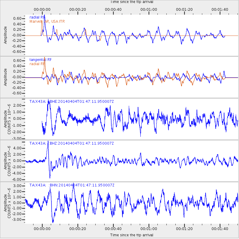
X43A Marvell, AR, USA - Earthquake Result Viewer
*The percent match for this event was below the threshold and hence no stack was calculated.
| Earthquake location: |
Near Coast Of Northern Chile |
| Earthquake latitude/longitude: |
-20.6/-70.7 |
| Earthquake time(UTC): |
2014/04/04 (094) 01:37:51 GMT |
| Earthquake Depth: |
20 km |
| Earthquake Magnitude: |
6.1 MWP, 6.1 MWB, 6.1 MWW, 6.3 MWC |
| Earthquake Catalog/Contributor: |
NEIC PDE/NEIC COMCAT |
|
| Network: |
TA USArray Transportable Network (new EarthScope stations) |
| Station: |
X43A Marvell, AR, USA |
| Lat/Lon: |
34.52 N/90.88 W |
| Elevation: |
53 m |
|
| Distance: |
58.1 deg |
| Az: |
340.429 deg |
| Baz: |
157.667 deg |
| Ray Param: |
$rayparam |
*The percent match for this event was below the threshold and hence was not used in the summary stack. |
|
| Radial Match: |
74.56128 % |
| Radial Bump: |
354 |
| Transverse Match: |
51.27796 % |
| Transverse Bump: |
354 |
| SOD ConfigId: |
626651 |
| Insert Time: |
2014-04-22 10:05:23.947 +0000 |
| GWidth: |
2.5 |
| Max Bumps: |
400 |
| Tol: |
0.001 |
|
Signal To Noise
| Channel | StoN | STA | LTA |
| TA:X43A: :BHZ:20140404T01:47:11.950007Z | 12.963232 | 2.6007901E-6 | 2.0062822E-7 |
| TA:X43A: :BHN:20140404T01:47:11.950007Z | 1.7161514 | 1.2281818E-6 | 7.156605E-7 |
| TA:X43A: :BHE:20140404T01:47:11.950007Z | 0.71688324 | 7.6878104E-7 | 1.0723936E-6 |
| Arrivals |
| Ps | |
| PpPs | |
| PsPs/PpSs | |


