You are here: Home > Network List > US - United States National Seismic Network Stations List
> Station DGMT Dagmar, Montana, USA > Earthquake Result Viewer
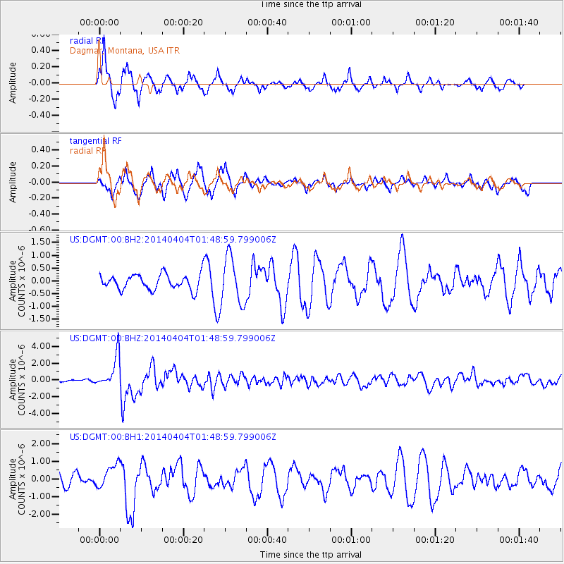
DGMT Dagmar, Montana, USA - Earthquake Result Viewer
*The percent match for this event was below the threshold and hence no stack was calculated.
| Earthquake location: |
Near Coast Of Northern Chile |
| Earthquake latitude/longitude: |
-20.6/-70.7 |
| Earthquake time(UTC): |
2014/04/04 (094) 01:37:51 GMT |
| Earthquake Depth: |
20 km |
| Earthquake Magnitude: |
6.1 MWP, 6.1 MWB, 6.1 MWW, 6.3 MWC |
| Earthquake Catalog/Contributor: |
NEIC PDE/NEIC COMCAT |
|
| Network: |
US United States National Seismic Network |
| Station: |
DGMT Dagmar, Montana, USA |
| Lat/Lon: |
48.47 N/104.20 W |
| Elevation: |
0.0 m |
|
| Distance: |
75.0 deg |
| Az: |
337.677 deg |
| Baz: |
147.683 deg |
| Ray Param: |
$rayparam |
*The percent match for this event was below the threshold and hence was not used in the summary stack. |
|
| Radial Match: |
80.75792 % |
| Radial Bump: |
326 |
| Transverse Match: |
61.700054 % |
| Transverse Bump: |
306 |
| SOD ConfigId: |
626651 |
| Insert Time: |
2014-04-22 10:07:12.646 +0000 |
| GWidth: |
2.5 |
| Max Bumps: |
400 |
| Tol: |
0.001 |
|
Signal To Noise
| Channel | StoN | STA | LTA |
| US:DGMT:00:BHZ:20140404T01:48:59.799006Z | 13.32876 | 1.9744664E-6 | 1.4813578E-7 |
| US:DGMT:00:BH1:20140404T01:48:59.799006Z | 1.4811318 | 6.640868E-7 | 4.4836443E-7 |
| US:DGMT:00:BH2:20140404T01:48:59.799006Z | 3.063264 | 9.149509E-7 | 2.9868497E-7 |
| Arrivals |
| Ps | |
| PpPs | |
| PsPs/PpSs | |


