You are here: Home > Network List > TA - USArray Transportable Network (new EarthScope stations) Stations List
> Station J04D Umpqua National Forest, Toketee, OR, USA > Earthquake Result Viewer
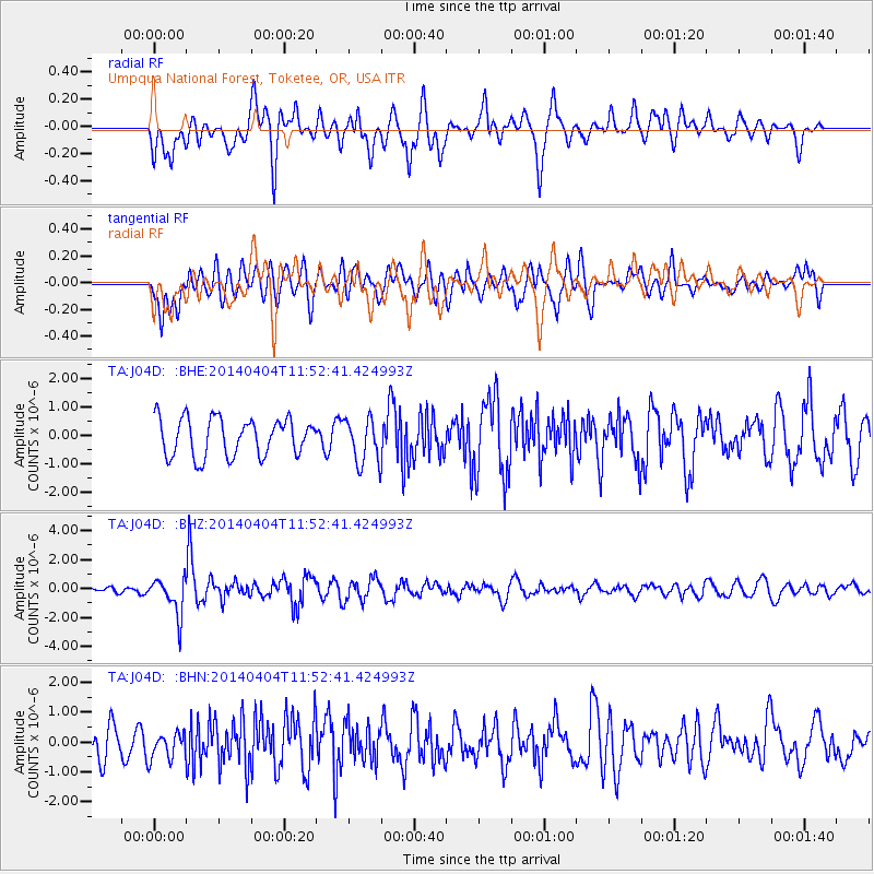
J04D Umpqua National Forest, Toketee, OR, USA - Earthquake Result Viewer
*The percent match for this event was below the threshold and hence no stack was calculated.
| Earthquake location: |
Solomon Islands |
| Earthquake latitude/longitude: |
-10.5/161.7 |
| Earthquake time(UTC): |
2014/04/04 (094) 11:40:32 GMT |
| Earthquake Depth: |
64 km |
| Earthquake Magnitude: |
6.0 MB, 6.0 MWC, 6.0 MWW, 6.0 MWB |
| Earthquake Catalog/Contributor: |
NEIC PDE/NEIC COMCAT |
|
| Network: |
TA USArray Transportable Network (new EarthScope stations) |
| Station: |
J04D Umpqua National Forest, Toketee, OR, USA |
| Lat/Lon: |
43.24 N/122.11 W |
| Elevation: |
1948 m |
|
| Distance: |
87.3 deg |
| Az: |
45.278 deg |
| Baz: |
252.967 deg |
| Ray Param: |
$rayparam |
*The percent match for this event was below the threshold and hence was not used in the summary stack. |
|
| Radial Match: |
61.473015 % |
| Radial Bump: |
400 |
| Transverse Match: |
56.952724 % |
| Transverse Bump: |
400 |
| SOD ConfigId: |
626651 |
| Insert Time: |
2014-04-22 10:31:19.221 +0000 |
| GWidth: |
2.5 |
| Max Bumps: |
400 |
| Tol: |
0.001 |
|
Signal To Noise
| Channel | StoN | STA | LTA |
| TA:J04D: :BHZ:20140404T11:52:41.424993Z | 5.430217 | 1.2873235E-6 | 2.3706669E-7 |
| TA:J04D: :BHN:20140404T11:52:41.424993Z | 0.87615913 | 4.480471E-7 | 5.113764E-7 |
| TA:J04D: :BHE:20140404T11:52:41.424993Z | 1.1884532 | 7.80525E-7 | 6.5675704E-7 |
| Arrivals |
| Ps | |
| PpPs | |
| PsPs/PpSs | |


