
DGAR Diego Garcia, Chagos Islands, Indian Ocean - Earthquake Result Viewer
| ||||||||||||||||||
| ||||||||||||||||||
| ||||||||||||||||||
|
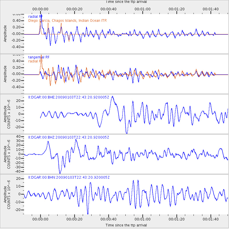
Signal To Noise
| Channel | StoN | STA | LTA |
| II:DGAR:00:BHZ:20090103T22:43:20.920005Z | 9.064901 | 1.2934336E-5 | 1.426859E-6 |
| II:DGAR:00:BHN:20090103T22:43:20.920005Z | 1.4145575 | 2.7040476E-6 | 1.9115855E-6 |
| II:DGAR:00:BHE:20090103T22:43:20.920005Z | 3.09602 | 8.169676E-6 | 2.6387675E-6 |
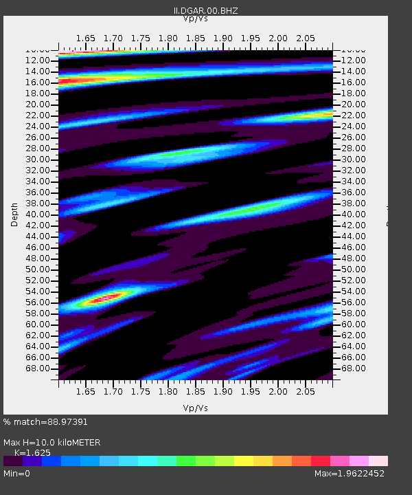
| Arrivals | |
| Ps | 1.2 SECOND |
| PpPs | 4.8 SECOND |
| PsPs/PpSs | 6.1 SECOND |

