You are here: Home > Network List > TA - USArray Transportable Network (new EarthScope stations) Stations List
> Station I47A Gladwin, MI, USA > Earthquake Result Viewer
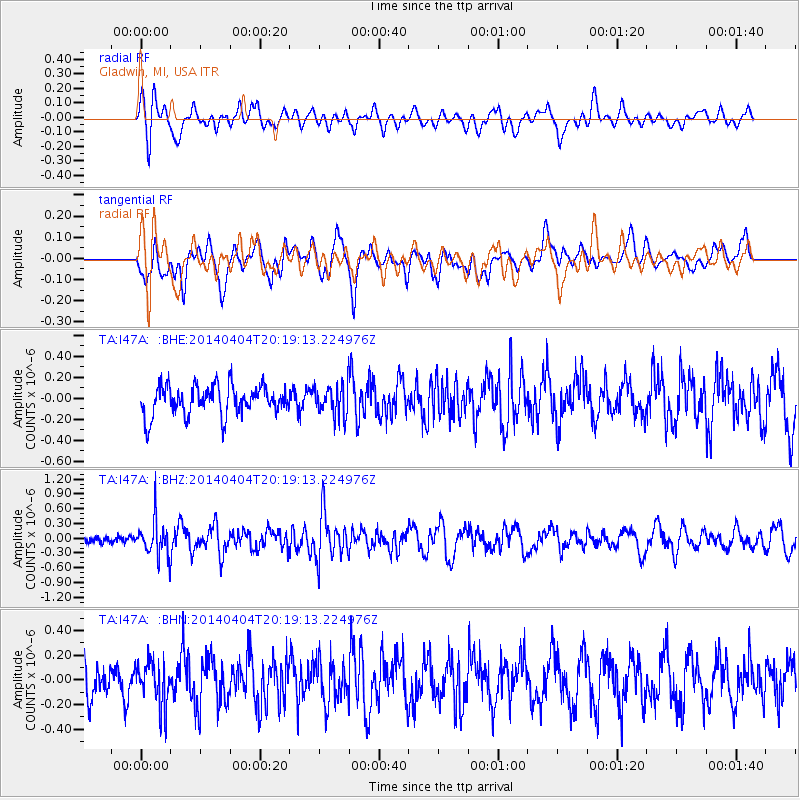
I47A Gladwin, MI, USA - Earthquake Result Viewer
*The percent match for this event was below the threshold and hence no stack was calculated.
| Earthquake location: |
Southern Greece |
| Earthquake latitude/longitude: |
37.2/23.8 |
| Earthquake time(UTC): |
2014/04/04 (094) 20:08:07 GMT |
| Earthquake Depth: |
107 km |
| Earthquake Magnitude: |
5.5 MWB, 5.5 MWR, 5.6 MWC, 5.6 MWW |
| Earthquake Catalog/Contributor: |
NEIC PDE/NEIC COMCAT |
|
| Network: |
TA USArray Transportable Network (new EarthScope stations) |
| Station: |
I47A Gladwin, MI, USA |
| Lat/Lon: |
44.02 N/84.51 W |
| Elevation: |
269 m |
|
| Distance: |
76.3 deg |
| Az: |
315.166 deg |
| Baz: |
51.261 deg |
| Ray Param: |
$rayparam |
*The percent match for this event was below the threshold and hence was not used in the summary stack. |
|
| Radial Match: |
54.578735 % |
| Radial Bump: |
400 |
| Transverse Match: |
51.52682 % |
| Transverse Bump: |
400 |
| SOD ConfigId: |
626651 |
| Insert Time: |
2014-04-22 10:56:08.540 +0000 |
| GWidth: |
2.5 |
| Max Bumps: |
400 |
| Tol: |
0.001 |
|
Signal To Noise
| Channel | StoN | STA | LTA |
| TA:I47A: :BHZ:20140404T20:19:13.224976Z | 2.3522828 | 3.7012364E-7 | 1.5734658E-7 |
| TA:I47A: :BHN:20140404T20:19:13.224976Z | 0.9939926 | 1.7578157E-7 | 1.7684393E-7 |
| TA:I47A: :BHE:20140404T20:19:13.224976Z | 1.0577977 | 1.5024162E-7 | 1.4203248E-7 |
| Arrivals |
| Ps | |
| PpPs | |
| PsPs/PpSs | |


