You are here: Home > Network List > TA - USArray Transportable Network (new EarthScope stations) Stations List
> Station Q53A Leroy, WV, USA > Earthquake Result Viewer
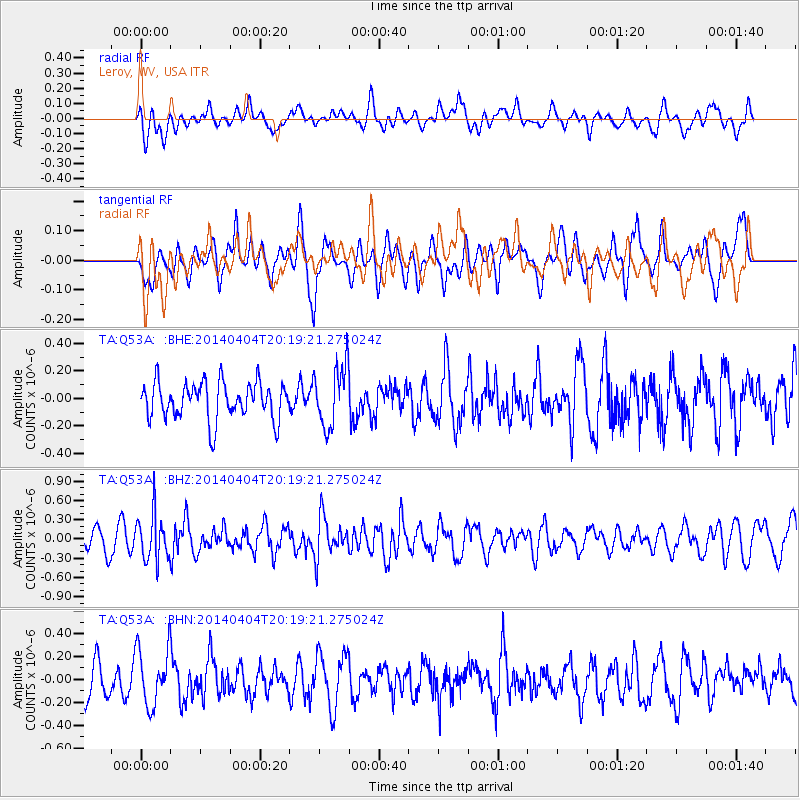
Q53A Leroy, WV, USA - Earthquake Result Viewer
*The percent match for this event was below the threshold and hence no stack was calculated.
| Earthquake location: |
Southern Greece |
| Earthquake latitude/longitude: |
37.2/23.8 |
| Earthquake time(UTC): |
2014/04/04 (094) 20:08:07 GMT |
| Earthquake Depth: |
107 km |
| Earthquake Magnitude: |
5.5 MWB, 5.5 MWR, 5.6 MWC, 5.6 MWW |
| Earthquake Catalog/Contributor: |
NEIC PDE/NEIC COMCAT |
|
| Network: |
TA USArray Transportable Network (new EarthScope stations) |
| Station: |
Q53A Leroy, WV, USA |
| Lat/Lon: |
38.86 N/81.53 W |
| Elevation: |
310 m |
|
| Distance: |
77.8 deg |
| Az: |
309.589 deg |
| Baz: |
51.978 deg |
| Ray Param: |
$rayparam |
*The percent match for this event was below the threshold and hence was not used in the summary stack. |
|
| Radial Match: |
45.824368 % |
| Radial Bump: |
400 |
| Transverse Match: |
56.756996 % |
| Transverse Bump: |
400 |
| SOD ConfigId: |
626651 |
| Insert Time: |
2014-04-22 11:00:04.562 +0000 |
| GWidth: |
2.5 |
| Max Bumps: |
400 |
| Tol: |
0.001 |
|
Signal To Noise
| Channel | StoN | STA | LTA |
| TA:Q53A: :BHZ:20140404T20:19:21.275024Z | 2.53467 | 3.6439627E-7 | 1.4376477E-7 |
| TA:Q53A: :BHN:20140404T20:19:21.275024Z | 1.5785351 | 2.4960104E-7 | 1.5812194E-7 |
| TA:Q53A: :BHE:20140404T20:19:21.275024Z | 1.6473643 | 2.214376E-7 | 1.3441932E-7 |
| Arrivals |
| Ps | |
| PpPs | |
| PsPs/PpSs | |


