You are here: Home > Network List > II - Global Seismograph Network (GSN - IRIS/IDA) Stations List
> Station DGAR Diego Garcia, Chagos Islands, Indian Ocean > Earthquake Result Viewer
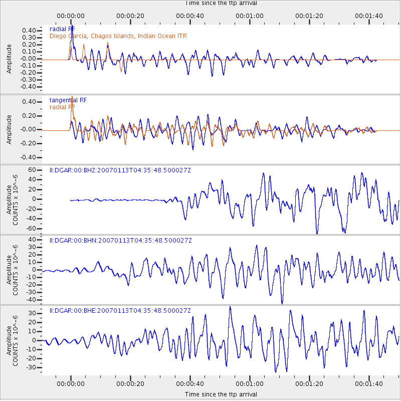
DGAR Diego Garcia, Chagos Islands, Indian Ocean - Earthquake Result Viewer

| Earthquake location: |
East Of Kuril Islands |
| Earthquake latitude/longitude: |
46.2/154.5 |
| Earthquake time(UTC): |
2007/01/13 (013) 04:23:21 GMT |
| Earthquake Depth: |
10 km |
| Earthquake Magnitude: |
7.3 MB, 8.2 MS, 8.1 MW, 7.9 MW |
| Earthquake Catalog/Contributor: |
WHDF/NEIC |
|
| Network: |
II Global Seismograph Network (GSN - IRIS/IDA) |
| Station: |
DGAR Diego Garcia, Chagos Islands, Indian Ocean |
| Lat/Lon: |
7.41 S/72.45 E |
| Elevation: |
1.0 m |
|
| Distance: |
89.8 deg |
| Az: |
259.197 deg |
| Baz: |
43.424 deg |
| Ray Param: |
0.041715547 |
| Estimated Moho Depth: |
55.5 km |
| Estimated Crust Vp/Vs: |
1.88 |
| Assumed Crust Vp: |
5.265 km/s |
| Estimated Crust Vs: |
2.793 km/s |
| Estimated Crust Poisson's Ratio: |
0.30 |
|
| Radial Match: |
85.12509 % |
| Radial Bump: |
400 |
| Transverse Match: |
69.043304 % |
| Transverse Bump: |
400 |
| SOD ConfigId: |
2564 |
| Insert Time: |
2010-03-01 20:22:09.085 +0000 |
| GWidth: |
2.5 |
| Max Bumps: |
400 |
| Tol: |
0.001 |
|
Signal To Noise
| Channel | StoN | STA | LTA |
| II:DGAR:00:BHN:20070113T04:35:48.500027Z | 1.2705827 | 2.2513748E-6 | 1.771923E-6 |
| II:DGAR:00:BHE:20070113T04:35:48.500027Z | 1.3482457 | 2.1538347E-6 | 1.5975089E-6 |
| II:DGAR:00:BHZ:20070113T04:35:48.500027Z | 2.3068638 | 1.9982222E-6 | 8.662073E-7 |
| Arrivals |
| Ps | 9.5 SECOND |
| PpPs | 30 SECOND |
| PsPs/PpSs | 39 SECOND |


