You are here: Home > Network List > II - Global Seismograph Network (GSN - IRIS/IDA) Stations List
> Station DGAR Diego Garcia, Chagos Islands, Indian Ocean > Earthquake Result Viewer
DGAR Diego Garcia, Chagos Islands, Indian Ocean - Earthquake Result Viewer

| Earthquake location: |
Kuril Islands |
| Earthquake latitude/longitude: |
46.6/153.3 |
| Earthquake time(UTC): |
2006/11/15 (319) 11:14:13 GMT |
| Earthquake Depth: |
10 km |
| Earthquake Magnitude: |
6.5 MB, 7.8 MS, 8.3 MW, 7.9 MW |
| Earthquake Catalog/Contributor: |
WHDF/NEIC |
|
| Network: |
II Global Seismograph Network (GSN - IRIS/IDA) |
| Station: |
DGAR Diego Garcia, Chagos Islands, Indian Ocean |
| Lat/Lon: |
7.41 S/72.45 E |
| Elevation: |
1.0 m |
|
| Distance: |
89.1 deg |
| Az: |
258.284 deg |
| Baz: |
42.911 deg |
| Ray Param: |
0.042124715 |
| Estimated Moho Depth: |
56.5 km |
| Estimated Crust Vp/Vs: |
1.86 |
| Assumed Crust Vp: |
5.265 km/s |
| Estimated Crust Vs: |
2.827 km/s |
| Estimated Crust Poisson's Ratio: |
0.30 |
|
| Radial Match: |
93.02872 % |
| Radial Bump: |
400 |
| Transverse Match: |
81.8585 % |
| Transverse Bump: |
400 |
| SOD ConfigId: |
2564 |
| Insert Time: |
2010-03-01 20:22:17.184 +0000 |
| GWidth: |
2.5 |
| Max Bumps: |
400 |
| Tol: |
0.001 |
|
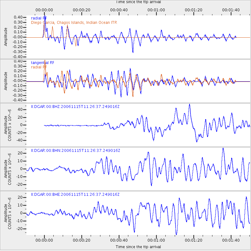
Signal To Noise
| Channel | StoN | STA | LTA |
| II:DGAR:00:BHN:20061115T11:26:37.249016Z | 0.9915054 | 1.0311687E-6 | 1.0400032E-6 |
| II:DGAR:00:BHE:20061115T11:26:37.249016Z | 0.8995318 | 9.4534425E-7 | 1.0509292E-6 |
| II:DGAR:00:BHZ:20061115T11:26:37.249016Z | 5.7616987 | 3.2778075E-6 | 5.6889604E-7 |
| Arrivals |
| Ps | 9.4 SECOND |
| PpPs | 30 SECOND |
| PsPs/PpSs | 40 SECOND |


