
DGAR Diego Garcia, Chagos Islands, Indian Ocean - Earthquake Result Viewer
| ||||||||||||||||||
| ||||||||||||||||||
| ||||||||||||||||||
|
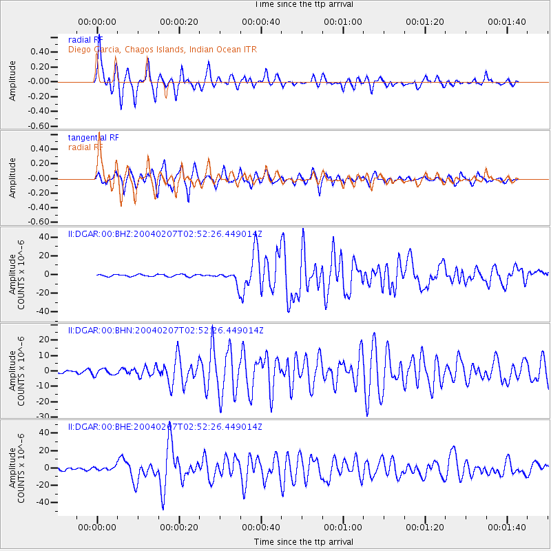
Signal To Noise
| Channel | StoN | STA | LTA |
| II:DGAR:00:BHN:20040207T02:52:26.449014Z | 1.9339772 | 2.0615041E-6 | 1.0659403E-6 |
| II:DGAR:00:BHE:20040207T02:52:26.449014Z | 1.1327579 | 2.1539188E-6 | 1.9014819E-6 |
| II:DGAR:00:BHZ:20040207T02:52:26.449014Z | 6.2118897 | 6.820736E-6 | 1.0980131E-6 |
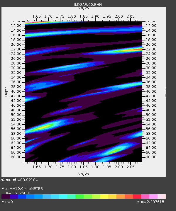
| Arrivals | |
| Ps | 1.2 SECOND |
| PpPs | 4.8 SECOND |
| PsPs/PpSs | 6.0 SECOND |

