You are here: Home > Network List > UW - Pacific Northwest Regional Seismic Network Stations List
> Station MRBL Marblemount, WA, USA > Earthquake Result Viewer
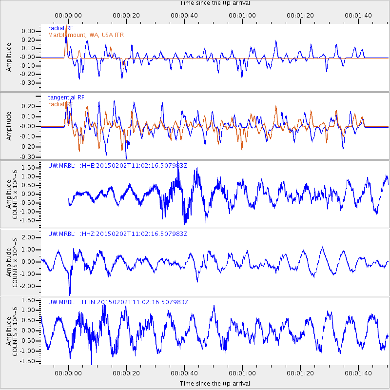
MRBL Marblemount, WA, USA - Earthquake Result Viewer
*The percent match for this event was below the threshold and hence no stack was calculated.
| Earthquake location: |
Mendoza Province, Argentina |
| Earthquake latitude/longitude: |
-32.7/-67.1 |
| Earthquake time(UTC): |
2015/02/02 (033) 10:49:48 GMT |
| Earthquake Depth: |
172 km |
| Earthquake Magnitude: |
6.3 MO |
| Earthquake Catalog/Contributor: |
NEIC PDE/NEIC ALERT |
|
| Network: |
UW Pacific Northwest Regional Seismic Network |
| Station: |
MRBL Marblemount, WA, USA |
| Lat/Lon: |
48.52 N/121.48 W |
| Elevation: |
75 m |
|
| Distance: |
94.3 deg |
| Az: |
327.158 deg |
| Baz: |
136.558 deg |
| Ray Param: |
$rayparam |
*The percent match for this event was below the threshold and hence was not used in the summary stack. |
|
| Radial Match: |
77.682045 % |
| Radial Bump: |
391 |
| Transverse Match: |
77.516785 % |
| Transverse Bump: |
400 |
| SOD ConfigId: |
6980671 |
| Insert Time: |
2019-04-16 11:48:30.887 +0000 |
| GWidth: |
2.5 |
| Max Bumps: |
400 |
| Tol: |
0.001 |
|
Signal To Noise
| Channel | StoN | STA | LTA |
| UW:MRBL: :HHZ:20150202T11:02:16.507983Z | 3.1779974 | 9.855263E-7 | 3.1010921E-7 |
| UW:MRBL: :HHN:20150202T11:02:16.507983Z | 1.1225266 | 6.1752E-7 | 5.5011617E-7 |
| UW:MRBL: :HHE:20150202T11:02:16.507983Z | 1.8974316 | 5.1101574E-7 | 2.693197E-7 |
| Arrivals |
| Ps | |
| PpPs | |
| PsPs/PpSs | |


