You are here: Home > Network List > II - Global Seismograph Network (GSN - IRIS/IDA) Stations List
> Station DGAR Diego Garcia, Chagos Islands, Indian Ocean > Earthquake Result Viewer
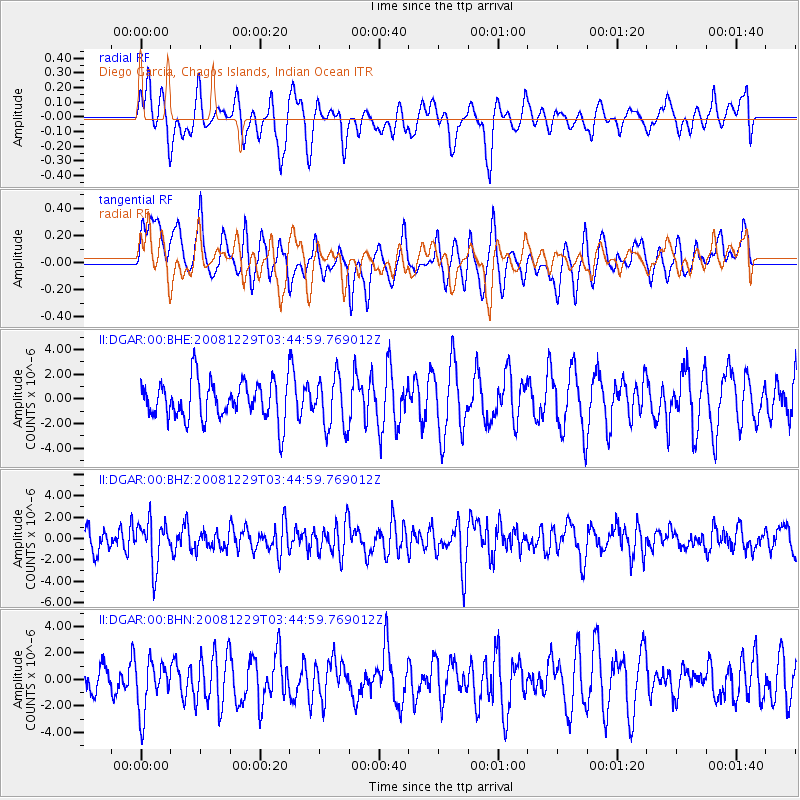
DGAR Diego Garcia, Chagos Islands, Indian Ocean - Earthquake Result Viewer
*The percent match for this event was below the threshold and hence no stack was calculated.
| Earthquake location: |
Afghanistan-Tajikistan Bord Reg. |
| Earthquake latitude/longitude: |
36.4/71.1 |
| Earthquake time(UTC): |
2008/12/29 (364) 03:37:41 GMT |
| Earthquake Depth: |
158 km |
| Earthquake Magnitude: |
5.9 MB, 5.8 MW, 5.8 MW |
| Earthquake Catalog/Contributor: |
WHDF/NEIC |
|
| Network: |
II Global Seismograph Network (GSN - IRIS/IDA) |
| Station: |
DGAR Diego Garcia, Chagos Islands, Indian Ocean |
| Lat/Lon: |
7.41 S/72.45 E |
| Elevation: |
1.0 m |
|
| Distance: |
43.6 deg |
| Az: |
178.019 deg |
| Baz: |
358.388 deg |
| Ray Param: |
$rayparam |
*The percent match for this event was below the threshold and hence was not used in the summary stack. |
|
| Radial Match: |
51.662437 % |
| Radial Bump: |
400 |
| Transverse Match: |
49.707897 % |
| Transverse Bump: |
400 |
| SOD ConfigId: |
2658 |
| Insert Time: |
2010-03-01 20:27:51.611 +0000 |
| GWidth: |
2.5 |
| Max Bumps: |
400 |
| Tol: |
0.001 |
|
Signal To Noise
| Channel | StoN | STA | LTA |
| II:DGAR:00:BHZ:20081229T03:44:59.769012Z | 1.8613838 | 2.1089259E-6 | 1.1329882E-6 |
| II:DGAR:00:BHN:20081229T03:44:59.769012Z | 1.3278674 | 1.9423242E-6 | 1.4627396E-6 |
| II:DGAR:00:BHE:20081229T03:44:59.769012Z | 1.3389795 | 2.0848113E-6 | 1.557015E-6 |
| Arrivals |
| Ps | |
| PpPs | |
| PsPs/PpSs | |


