You are here: Home > Network List > TA - USArray Transportable Network (new EarthScope stations) Stations List
> Station G65A Princeton, ME, USA > Earthquake Result Viewer
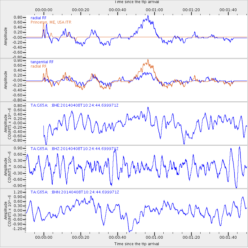
G65A Princeton, ME, USA - Earthquake Result Viewer
*The percent match for this event was below the threshold and hence no stack was calculated.
| Earthquake location: |
Near Coast Of Northern Chile |
| Earthquake latitude/longitude: |
-20.5/-70.9 |
| Earthquake time(UTC): |
2014/04/08 (098) 10:14:32 GMT |
| Earthquake Depth: |
7.1 km |
| Earthquake Magnitude: |
5.7 MWB, 5.5 MWR, 5.6 MWC, 5.6 MWW |
| Earthquake Catalog/Contributor: |
NEIC PDE/NEIC COMCAT |
|
| Network: |
TA USArray Transportable Network (new EarthScope stations) |
| Station: |
G65A Princeton, ME, USA |
| Lat/Lon: |
45.20 N/67.56 W |
| Elevation: |
78 m |
|
| Distance: |
65.4 deg |
| Az: |
2.619 deg |
| Baz: |
183.474 deg |
| Ray Param: |
$rayparam |
*The percent match for this event was below the threshold and hence was not used in the summary stack. |
|
| Radial Match: |
33.379063 % |
| Radial Bump: |
400 |
| Transverse Match: |
29.821817 % |
| Transverse Bump: |
400 |
| SOD ConfigId: |
626651 |
| Insert Time: |
2014-04-22 12:30:10.660 +0000 |
| GWidth: |
2.5 |
| Max Bumps: |
400 |
| Tol: |
0.001 |
|
Signal To Noise
| Channel | StoN | STA | LTA |
| TA:G65A: :BHZ:20140408T10:24:44.699971Z | 1.4247926 | 3.9597847E-7 | 2.7792007E-7 |
| TA:G65A: :BHN:20140408T10:24:44.699971Z | 0.48644584 | 2.6181823E-7 | 5.3822686E-7 |
| TA:G65A: :BHE:20140408T10:24:44.699971Z | 0.69534856 | 2.3847255E-7 | 3.42954E-7 |
| Arrivals |
| Ps | |
| PpPs | |
| PsPs/PpSs | |


