You are here: Home > Network List > TA - USArray Transportable Network (new EarthScope stations) Stations List
> Station S49A Springfield, KY, USA > Earthquake Result Viewer
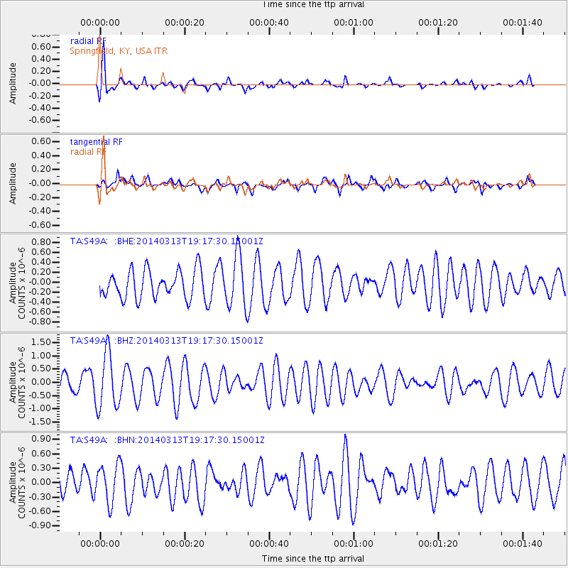
S49A Springfield, KY, USA - Earthquake Result Viewer
*The percent match for this event was below the threshold and hence no stack was calculated.
| Earthquake location: |
Off Coast Of Northern California |
| Earthquake latitude/longitude: |
41.9/-126.9 |
| Earthquake time(UTC): |
2014/03/13 (072) 19:11:34 GMT |
| Earthquake Depth: |
10 km |
| Earthquake Magnitude: |
5.5 MWW, 4.0 ML, 5.5 MWC, 5.6 MI |
| Earthquake Catalog/Contributor: |
NEIC PDE/NEIC COMCAT |
|
| Network: |
TA USArray Transportable Network (new EarthScope stations) |
| Station: |
S49A Springfield, KY, USA |
| Lat/Lon: |
37.78 N/85.29 W |
| Elevation: |
230 m |
|
| Distance: |
32.0 deg |
| Az: |
83.356 deg |
| Baz: |
290.634 deg |
| Ray Param: |
$rayparam |
*The percent match for this event was below the threshold and hence was not used in the summary stack. |
|
| Radial Match: |
77.19601 % |
| Radial Bump: |
400 |
| Transverse Match: |
56.442608 % |
| Transverse Bump: |
400 |
| SOD ConfigId: |
626651 |
| Insert Time: |
2014-04-22 15:57:42.619 +0000 |
| GWidth: |
2.5 |
| Max Bumps: |
400 |
| Tol: |
0.001 |
|
Signal To Noise
| Channel | StoN | STA | LTA |
| TA:S49A: :BHZ:20140313T19:17:30.15001Z | 2.8080556 | 1.0604194E-6 | 3.7763476E-7 |
| TA:S49A: :BHN:20140313T19:17:30.15001Z | 1.3281007 | 4.0437203E-7 | 3.0447396E-7 |
| TA:S49A: :BHE:20140313T19:17:30.15001Z | 1.9095787 | 5.247746E-7 | 2.7481173E-7 |
| Arrivals |
| Ps | |
| PpPs | |
| PsPs/PpSs | |


