You are here: Home > Network List > IU - Global Seismograph Network (GSN - IRIS/USGS) Stations List
> Station PMG Port Moresby, New Guinea > Earthquake Result Viewer
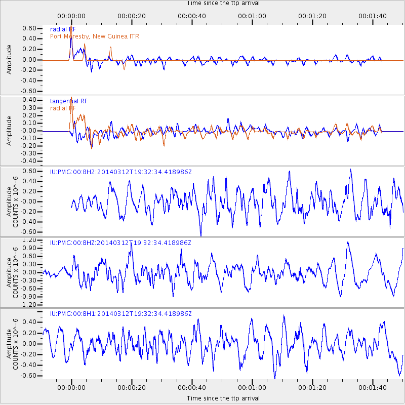
PMG Port Moresby, New Guinea - Earthquake Result Viewer
*The percent match for this event was below the threshold and hence no stack was calculated.
| Earthquake location: |
Tonga Islands Region |
| Earthquake latitude/longitude: |
-23.5/-175.1 |
| Earthquake time(UTC): |
2014/03/12 (071) 19:25:42 GMT |
| Earthquake Depth: |
17 km |
| Earthquake Magnitude: |
5.6 MWW, 5.4 MWB, 5.6 MWC |
| Earthquake Catalog/Contributor: |
NEIC PDE/NEIC COMCAT |
|
| Network: |
IU Global Seismograph Network (GSN - IRIS/USGS) |
| Station: |
PMG Port Moresby, New Guinea |
| Lat/Lon: |
9.40 S/147.16 E |
| Elevation: |
90 m |
|
| Distance: |
38.7 deg |
| Az: |
284.809 deg |
| Baz: |
115.89 deg |
| Ray Param: |
$rayparam |
*The percent match for this event was below the threshold and hence was not used in the summary stack. |
|
| Radial Match: |
60.469616 % |
| Radial Bump: |
400 |
| Transverse Match: |
39.77441 % |
| Transverse Bump: |
400 |
| SOD ConfigId: |
626651 |
| Insert Time: |
2014-04-22 16:17:18.824 +0000 |
| GWidth: |
2.5 |
| Max Bumps: |
400 |
| Tol: |
0.001 |
|
Signal To Noise
| Channel | StoN | STA | LTA |
| IU:PMG:00:BHZ:20140312T19:32:34.418986Z | 1.5279413 | 3.3747168E-7 | 2.2086691E-7 |
| IU:PMG:00:BH1:20140312T19:32:34.418986Z | 0.8638323 | 1.9372841E-7 | 2.2426623E-7 |
| IU:PMG:00:BH2:20140312T19:32:34.418986Z | 0.8114276 | 1.5084092E-7 | 1.8589573E-7 |
| Arrivals |
| Ps | |
| PpPs | |
| PsPs/PpSs | |


