You are here: Home > Network List > TA - USArray Transportable Network (new EarthScope stations) Stations List
> Station Q24A Divide, CO, USA > Earthquake Result Viewer
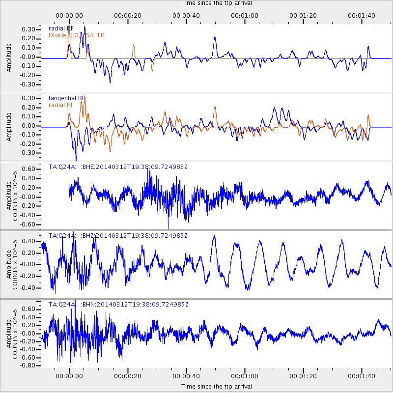
Q24A Divide, CO, USA - Earthquake Result Viewer
*The percent match for this event was below the threshold and hence no stack was calculated.
| Earthquake location: |
Tonga Islands Region |
| Earthquake latitude/longitude: |
-23.5/-175.1 |
| Earthquake time(UTC): |
2014/03/12 (071) 19:25:42 GMT |
| Earthquake Depth: |
17 km |
| Earthquake Magnitude: |
5.6 MWW, 5.4 MWB, 5.6 MWC |
| Earthquake Catalog/Contributor: |
NEIC PDE/NEIC COMCAT |
|
| Network: |
TA USArray Transportable Network (new EarthScope stations) |
| Station: |
Q24A Divide, CO, USA |
| Lat/Lon: |
38.96 N/105.15 W |
| Elevation: |
2775 m |
|
| Distance: |
90.1 deg |
| Az: |
47.067 deg |
| Baz: |
239.578 deg |
| Ray Param: |
$rayparam |
*The percent match for this event was below the threshold and hence was not used in the summary stack. |
|
| Radial Match: |
34.807076 % |
| Radial Bump: |
400 |
| Transverse Match: |
61.637383 % |
| Transverse Bump: |
400 |
| SOD ConfigId: |
626651 |
| Insert Time: |
2014-04-22 16:26:47.810 +0000 |
| GWidth: |
2.5 |
| Max Bumps: |
400 |
| Tol: |
0.001 |
|
Signal To Noise
| Channel | StoN | STA | LTA |
| TA:Q24A: :BHZ:20140312T19:38:09.724985Z | 0.9332687 | 2.2062706E-7 | 2.3640251E-7 |
| TA:Q24A: :BHN:20140312T19:38:09.724985Z | 1.9978516 | 3.1573853E-7 | 1.5803903E-7 |
| TA:Q24A: :BHE:20140312T19:38:09.724985Z | 1.4133538 | 2.1289763E-7 | 1.5063293E-7 |
| Arrivals |
| Ps | |
| PpPs | |
| PsPs/PpSs | |


