You are here: Home > Network List > WY - Yellowstone Wyoming Seismic Network Stations List
> Station YHH Holmes Hill, YNP, WY, USA > Earthquake Result Viewer
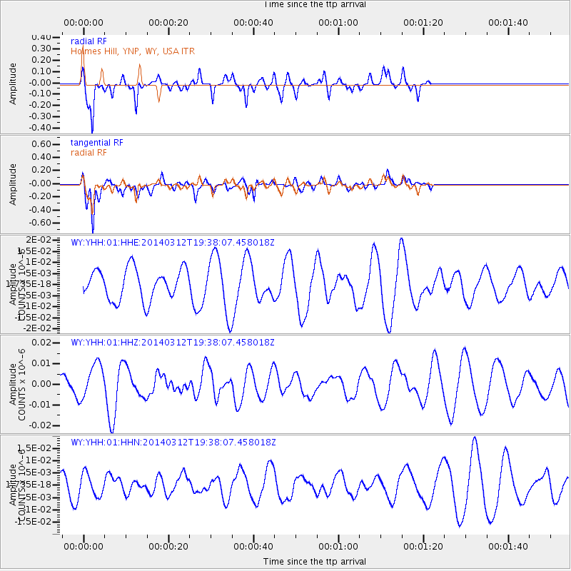
YHH Holmes Hill, YNP, WY, USA - Earthquake Result Viewer
*The percent match for this event was below the threshold and hence no stack was calculated.
| Earthquake location: |
Tonga Islands Region |
| Earthquake latitude/longitude: |
-23.5/-175.1 |
| Earthquake time(UTC): |
2014/03/12 (071) 19:25:42 GMT |
| Earthquake Depth: |
17 km |
| Earthquake Magnitude: |
5.6 MWW, 5.4 MWB, 5.6 MWC |
| Earthquake Catalog/Contributor: |
NEIC PDE/NEIC COMCAT |
|
| Network: |
WY Yellowstone Wyoming Seismic Network |
| Station: |
YHH Holmes Hill, YNP, WY, USA |
| Lat/Lon: |
44.79 N/110.85 W |
| Elevation: |
2717 m |
|
| Distance: |
89.6 deg |
| Az: |
39.877 deg |
| Baz: |
235.764 deg |
| Ray Param: |
$rayparam |
*The percent match for this event was below the threshold and hence was not used in the summary stack. |
|
| Radial Match: |
50.84123 % |
| Radial Bump: |
316 |
| Transverse Match: |
82.4899 % |
| Transverse Bump: |
400 |
| SOD ConfigId: |
626651 |
| Insert Time: |
2014-04-22 16:30:37.353 +0000 |
| GWidth: |
2.5 |
| Max Bumps: |
400 |
| Tol: |
0.001 |
|
Signal To Noise
| Channel | StoN | STA | LTA |
| WY:YHH:01:HHZ:20140312T19:38:07.458018Z | 1.2880424 | 8.718224E-9 | 6.7685852E-9 |
| WY:YHH:01:HHN:20140312T19:38:07.458018Z | 1.2161658 | 4.4791966E-9 | 3.6830476E-9 |
| WY:YHH:01:HHE:20140312T19:38:07.458018Z | 1.9517958 | 1.3388554E-8 | 6.859608E-9 |
| Arrivals |
| Ps | |
| PpPs | |
| PsPs/PpSs | |


