You are here: Home > Network List > TA - USArray Transportable Network (new EarthScope stations) Stations List
> Station G03D McMinnville, OR, USA > Earthquake Result Viewer
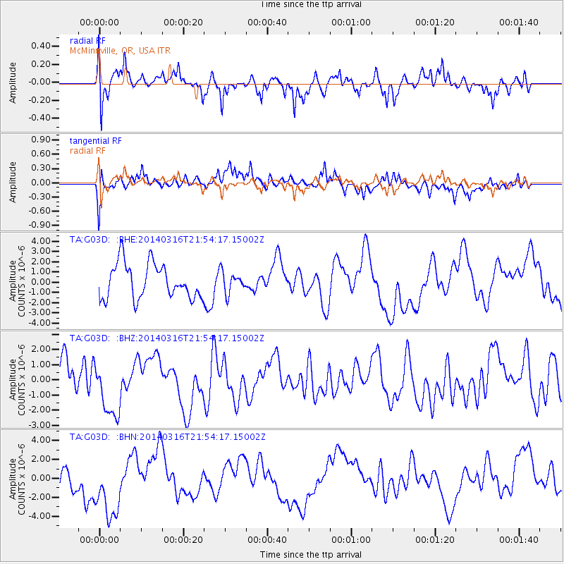
G03D McMinnville, OR, USA - Earthquake Result Viewer
*The percent match for this event was below the threshold and hence no stack was calculated.
| Earthquake location: |
Southeast Of Shikoku, Japan |
| Earthquake latitude/longitude: |
29.4/133.7 |
| Earthquake time(UTC): |
2014/03/16 (075) 21:42:50 GMT |
| Earthquake Depth: |
16 km |
| Earthquake Magnitude: |
5.8 MB |
| Earthquake Catalog/Contributor: |
NEIC PDE/NEIC COMCAT |
|
| Network: |
TA USArray Transportable Network (new EarthScope stations) |
| Station: |
G03D McMinnville, OR, USA |
| Lat/Lon: |
45.21 N/123.26 W |
| Elevation: |
222 m |
|
| Distance: |
78.1 deg |
| Az: |
44.731 deg |
| Baz: |
299.66 deg |
| Ray Param: |
$rayparam |
*The percent match for this event was below the threshold and hence was not used in the summary stack. |
|
| Radial Match: |
55.48921 % |
| Radial Bump: |
400 |
| Transverse Match: |
60.131546 % |
| Transverse Bump: |
400 |
| SOD ConfigId: |
626651 |
| Insert Time: |
2014-04-23 05:59:35.977 +0000 |
| GWidth: |
2.5 |
| Max Bumps: |
400 |
| Tol: |
0.001 |
|
Signal To Noise
| Channel | StoN | STA | LTA |
| TA:G03D: :BHZ:20140316T21:54:17.15002Z | 1.6201293 | 1.8912478E-6 | 1.1673437E-6 |
| TA:G03D: :BHN:20140316T21:54:17.15002Z | 2.6775198 | 3.546795E-6 | 1.3246568E-6 |
| TA:G03D: :BHE:20140316T21:54:17.15002Z | 0.5735298 | 9.716052E-7 | 1.6940799E-6 |
| Arrivals |
| Ps | |
| PpPs | |
| PsPs/PpSs | |


