You are here: Home > Network List > US - United States National Seismic Network Stations List
> Station MNTX Cornudas Mountains, Texas, USA > Earthquake Result Viewer
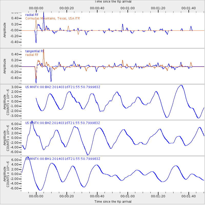
MNTX Cornudas Mountains, Texas, USA - Earthquake Result Viewer
*The percent match for this event was below the threshold and hence no stack was calculated.
| Earthquake location: |
Southeast Of Shikoku, Japan |
| Earthquake latitude/longitude: |
29.4/133.7 |
| Earthquake time(UTC): |
2014/03/16 (075) 21:42:50 GMT |
| Earthquake Depth: |
16 km |
| Earthquake Magnitude: |
5.8 MB |
| Earthquake Catalog/Contributor: |
NEIC PDE/NEIC COMCAT |
|
| Network: |
US United States National Seismic Network |
| Station: |
MNTX Cornudas Mountains, Texas, USA |
| Lat/Lon: |
31.70 N/105.38 W |
| Elevation: |
404 m |
|
| Distance: |
97.3 deg |
| Az: |
47.5 deg |
| Baz: |
310.982 deg |
| Ray Param: |
$rayparam |
*The percent match for this event was below the threshold and hence was not used in the summary stack. |
|
| Radial Match: |
83.28926 % |
| Radial Bump: |
297 |
| Transverse Match: |
41.041737 % |
| Transverse Bump: |
400 |
| SOD ConfigId: |
626651 |
| Insert Time: |
2014-04-23 06:00:55.792 +0000 |
| GWidth: |
2.5 |
| Max Bumps: |
400 |
| Tol: |
0.001 |
|
Signal To Noise
| Channel | StoN | STA | LTA |
| US:MNTX:00:BHZ:20140316T21:55:50.799983Z | 0.781721 | 2.5749255E-6 | 3.2939188E-6 |
| US:MNTX:00:BH1:20140316T21:55:50.799983Z | 1.5605986 | 5.6524286E-6 | 3.6219617E-6 |
| US:MNTX:00:BH2:20140316T21:55:50.799983Z | 0.81786364 | 1.0604274E-6 | 1.2965821E-6 |
| Arrivals |
| Ps | |
| PpPs | |
| PsPs/PpSs | |


