You are here: Home > Network List > US - United States National Seismic Network Stations List
> Station WUAZ Wupatki, Arizona, USA > Earthquake Result Viewer
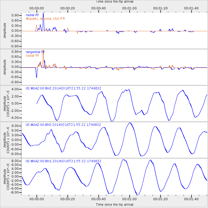
WUAZ Wupatki, Arizona, USA - Earthquake Result Viewer
*The percent match for this event was below the threshold and hence no stack was calculated.
| Earthquake location: |
Southeast Of Shikoku, Japan |
| Earthquake latitude/longitude: |
29.4/133.7 |
| Earthquake time(UTC): |
2014/03/16 (075) 21:42:50 GMT |
| Earthquake Depth: |
16 km |
| Earthquake Magnitude: |
5.8 MB |
| Earthquake Catalog/Contributor: |
NEIC PDE/NEIC COMCAT |
|
| Network: |
US United States National Seismic Network |
| Station: |
WUAZ Wupatki, Arizona, USA |
| Lat/Lon: |
35.52 N/111.37 W |
| Elevation: |
1592 m |
|
| Distance: |
91.0 deg |
| Az: |
47.726 deg |
| Baz: |
307.66 deg |
| Ray Param: |
$rayparam |
*The percent match for this event was below the threshold and hence was not used in the summary stack. |
|
| Radial Match: |
96.6338 % |
| Radial Bump: |
291 |
| Transverse Match: |
79.65634 % |
| Transverse Bump: |
400 |
| SOD ConfigId: |
626651 |
| Insert Time: |
2014-04-23 06:01:09.670 +0000 |
| GWidth: |
2.5 |
| Max Bumps: |
400 |
| Tol: |
0.001 |
|
Signal To Noise
| Channel | StoN | STA | LTA |
| US:WUAZ:00:BHZ:20140316T21:55:22.174983Z | 1.345282 | 2.7587855E-6 | 2.0507118E-6 |
| US:WUAZ:00:BH1:20140316T21:55:22.174983Z | 1.5572656 | 3.019562E-6 | 1.9390152E-6 |
| US:WUAZ:00:BH2:20140316T21:55:22.174983Z | 1.0498534 | 2.3929242E-6 | 2.2792938E-6 |
| Arrivals |
| Ps | |
| PpPs | |
| PsPs/PpSs | |


