You are here: Home > Network List > TA - USArray Transportable Network (new EarthScope stations) Stations List
> Station M47A Cromwell, IN, USA > Earthquake Result Viewer
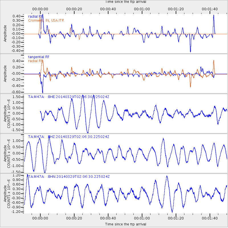
M47A Cromwell, IN, USA - Earthquake Result Viewer
*The percent match for this event was below the threshold and hence no stack was calculated.
| Earthquake location: |
Near East Coast Of Honshu, Japan |
| Earthquake latitude/longitude: |
36.3/141.8 |
| Earthquake time(UTC): |
2014/03/29 (088) 01:53:57 GMT |
| Earthquake Depth: |
20 km |
| Earthquake Magnitude: |
5.5 MWC, 5.4 MWB, 5.5 MWC |
| Earthquake Catalog/Contributor: |
NEIC PDE/NEIC COMCAT |
|
| Network: |
TA USArray Transportable Network (new EarthScope stations) |
| Station: |
M47A Cromwell, IN, USA |
| Lat/Lon: |
41.36 N/85.62 W |
| Elevation: |
283 m |
|
| Distance: |
91.3 deg |
| Az: |
33.698 deg |
| Baz: |
323.471 deg |
| Ray Param: |
$rayparam |
*The percent match for this event was below the threshold and hence was not used in the summary stack. |
|
| Radial Match: |
66.0554 % |
| Radial Bump: |
400 |
| Transverse Match: |
85.89277 % |
| Transverse Bump: |
395 |
| SOD ConfigId: |
626651 |
| Insert Time: |
2014-04-24 01:12:22.764 +0000 |
| GWidth: |
2.5 |
| Max Bumps: |
400 |
| Tol: |
0.001 |
|
Signal To Noise
| Channel | StoN | STA | LTA |
| TA:M47A: :BHZ:20140329T02:06:30.225024Z | 1.8893559 | 9.88626E-7 | 5.2326084E-7 |
| TA:M47A: :BHN:20140329T02:06:30.225024Z | 0.8317925 | 3.6205728E-7 | 4.3527356E-7 |
| TA:M47A: :BHE:20140329T02:06:30.225024Z | 1.6781496 | 1.0343392E-6 | 6.1635706E-7 |
| Arrivals |
| Ps | |
| PpPs | |
| PsPs/PpSs | |


