You are here: Home > Network List > TA - USArray Transportable Network (new EarthScope stations) Stations List
> Station P57A Homestead Farm, Martinsburg, WV, USA > Earthquake Result Viewer
P57A Homestead Farm, Martinsburg, WV, USA - Earthquake Result Viewer
*The percent match for this event was below the threshold and hence no stack was calculated.
| Earthquake location: |
Near East Coast Of Honshu, Japan |
| Earthquake latitude/longitude: |
36.3/141.8 |
| Earthquake time(UTC): |
2014/03/29 (088) 01:53:57 GMT |
| Earthquake Depth: |
20 km |
| Earthquake Magnitude: |
5.5 MWC, 5.4 MWB, 5.5 MWC |
| Earthquake Catalog/Contributor: |
NEIC PDE/NEIC COMCAT |
|
| Network: |
TA USArray Transportable Network (new EarthScope stations) |
| Station: |
P57A Homestead Farm, Martinsburg, WV, USA |
| Lat/Lon: |
39.48 N/78.01 W |
| Elevation: |
191 m |
|
| Distance: |
96.1 deg |
| Az: |
29.918 deg |
| Baz: |
328.635 deg |
| Ray Param: |
$rayparam |
*The percent match for this event was below the threshold and hence was not used in the summary stack. |
|
| Radial Match: |
76.21181 % |
| Radial Bump: |
400 |
| Transverse Match: |
75.40524 % |
| Transverse Bump: |
400 |
| SOD ConfigId: |
626651 |
| Insert Time: |
2014-04-24 01:14:10.243 +0000 |
| GWidth: |
2.5 |
| Max Bumps: |
400 |
| Tol: |
0.001 |
|
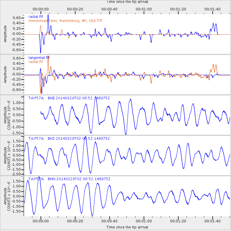
Signal To Noise
| Channel | StoN | STA | LTA |
| TA:P57A: :BHZ:20140329T02:06:52.148975Z | 0.5803968 | 4.249244E-7 | 7.3212743E-7 |
| TA:P57A: :BHN:20140329T02:06:52.148975Z | 1.0896584 | 1.0169331E-6 | 9.3325855E-7 |
| TA:P57A: :BHE:20140329T02:06:52.148975Z | 2.2140973 | 9.830694E-7 | 4.440046E-7 |
| Arrivals |
| Ps | |
| PpPs | |
| PsPs/PpSs | |


