You are here: Home > Network List > TA - USArray Transportable Network (new EarthScope stations) Stations List
> Station R53A Hurricane, WV, USA > Earthquake Result Viewer
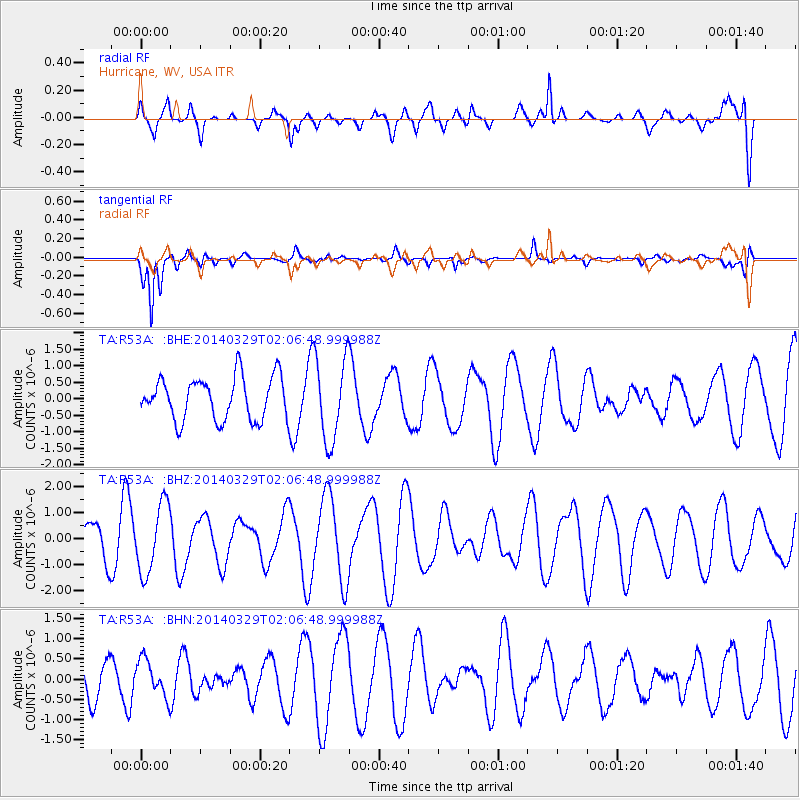
R53A Hurricane, WV, USA - Earthquake Result Viewer
*The percent match for this event was below the threshold and hence no stack was calculated.
| Earthquake location: |
Near East Coast Of Honshu, Japan |
| Earthquake latitude/longitude: |
36.3/141.8 |
| Earthquake time(UTC): |
2014/03/29 (088) 01:53:57 GMT |
| Earthquake Depth: |
20 km |
| Earthquake Magnitude: |
5.5 MWC, 5.4 MWB, 5.5 MWC |
| Earthquake Catalog/Contributor: |
NEIC PDE/NEIC COMCAT |
|
| Network: |
TA USArray Transportable Network (new EarthScope stations) |
| Station: |
R53A Hurricane, WV, USA |
| Lat/Lon: |
38.33 N/81.95 W |
| Elevation: |
294 m |
|
| Distance: |
95.4 deg |
| Az: |
33.141 deg |
| Baz: |
325.847 deg |
| Ray Param: |
$rayparam |
*The percent match for this event was below the threshold and hence was not used in the summary stack. |
|
| Radial Match: |
62.89855 % |
| Radial Bump: |
400 |
| Transverse Match: |
89.32039 % |
| Transverse Bump: |
400 |
| SOD ConfigId: |
626651 |
| Insert Time: |
2014-04-24 01:14:51.510 +0000 |
| GWidth: |
2.5 |
| Max Bumps: |
400 |
| Tol: |
0.001 |
|
Signal To Noise
| Channel | StoN | STA | LTA |
| TA:R53A: :BHZ:20140329T02:06:48.999988Z | 1.93181 | 1.3351926E-6 | 6.911614E-7 |
| TA:R53A: :BHN:20140329T02:06:48.999988Z | 0.5482449 | 4.5688327E-7 | 8.3335624E-7 |
| TA:R53A: :BHE:20140329T02:06:48.999988Z | 1.9610417 | 1.2622185E-6 | 6.436469E-7 |
| Arrivals |
| Ps | |
| PpPs | |
| PsPs/PpSs | |


