You are here: Home > Network List > US - United States National Seismic Network Stations List
> Station AMTX Amarillo, Texas, USA > Earthquake Result Viewer
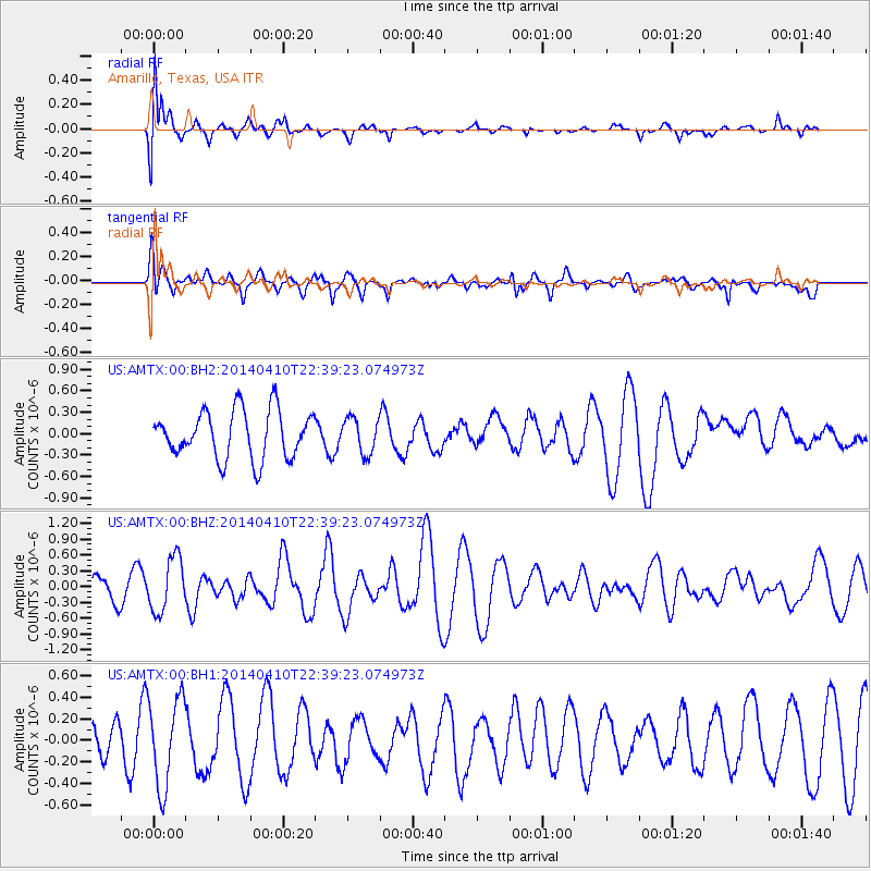
AMTX Amarillo, Texas, USA - Earthquake Result Viewer
*The percent match for this event was below the threshold and hence no stack was calculated.
| Earthquake location: |
Tonga Islands |
| Earthquake latitude/longitude: |
-19.2/-173.5 |
| Earthquake time(UTC): |
2014/04/10 (100) 22:27:10 GMT |
| Earthquake Depth: |
14 km |
| Earthquake Magnitude: |
5.6 MWP |
| Earthquake Catalog/Contributor: |
NEIC PDE/NEIC COMCAT |
|
| Network: |
US United States National Seismic Network |
| Station: |
AMTX Amarillo, Texas, USA |
| Lat/Lon: |
34.53 N/101.41 W |
| Elevation: |
1010 m |
|
| Distance: |
86.9 deg |
| Az: |
51.891 deg |
| Baz: |
244.215 deg |
| Ray Param: |
$rayparam |
*The percent match for this event was below the threshold and hence was not used in the summary stack. |
|
| Radial Match: |
60.65618 % |
| Radial Bump: |
400 |
| Transverse Match: |
52.32329 % |
| Transverse Bump: |
400 |
| SOD ConfigId: |
626651 |
| Insert Time: |
2014-04-24 23:14:44.006 +0000 |
| GWidth: |
2.5 |
| Max Bumps: |
400 |
| Tol: |
0.001 |
|
Signal To Noise
| Channel | StoN | STA | LTA |
| US:AMTX:00:BHZ:20140410T22:39:23.074973Z | 2.593336 | 5.1103046E-7 | 1.9705523E-7 |
| US:AMTX:00:BH1:20140410T22:39:23.074973Z | 2.6062765 | 4.0998074E-7 | 1.5730517E-7 |
| US:AMTX:00:BH2:20140410T22:39:23.074973Z | 0.7688055 | 2.5546544E-7 | 3.3228875E-7 |
| Arrivals |
| Ps | |
| PpPs | |
| PsPs/PpSs | |


