You are here: Home > Network List > UW - Pacific Northwest Regional Seismic Network Stations List
> Station MRBL Marblemount, WA, USA > Earthquake Result Viewer
MRBL Marblemount, WA, USA - Earthquake Result Viewer
*The percent match for this event was below the threshold and hence no stack was calculated.
| Earthquake location: |
Near Coast Of Northern Chile |
| Earthquake latitude/longitude: |
-22.3/-70.9 |
| Earthquake time(UTC): |
2015/02/02 (033) 15:22:08 GMT |
| Earthquake Depth: |
14 km |
| Earthquake Magnitude: |
5.3 MW |
| Earthquake Catalog/Contributor: |
ISC/ISC |
|
| Network: |
UW Pacific Northwest Regional Seismic Network |
| Station: |
MRBL Marblemount, WA, USA |
| Lat/Lon: |
48.52 N/121.48 W |
| Elevation: |
75 m |
|
| Distance: |
83.8 deg |
| Az: |
328.869 deg |
| Baz: |
133.949 deg |
| Ray Param: |
$rayparam |
*The percent match for this event was below the threshold and hence was not used in the summary stack. |
|
| Radial Match: |
23.0854 % |
| Radial Bump: |
400 |
| Transverse Match: |
31.493162 % |
| Transverse Bump: |
400 |
| SOD ConfigId: |
7019011 |
| Insert Time: |
2019-04-16 15:19:22.875 +0000 |
| GWidth: |
2.5 |
| Max Bumps: |
400 |
| Tol: |
0.001 |
|
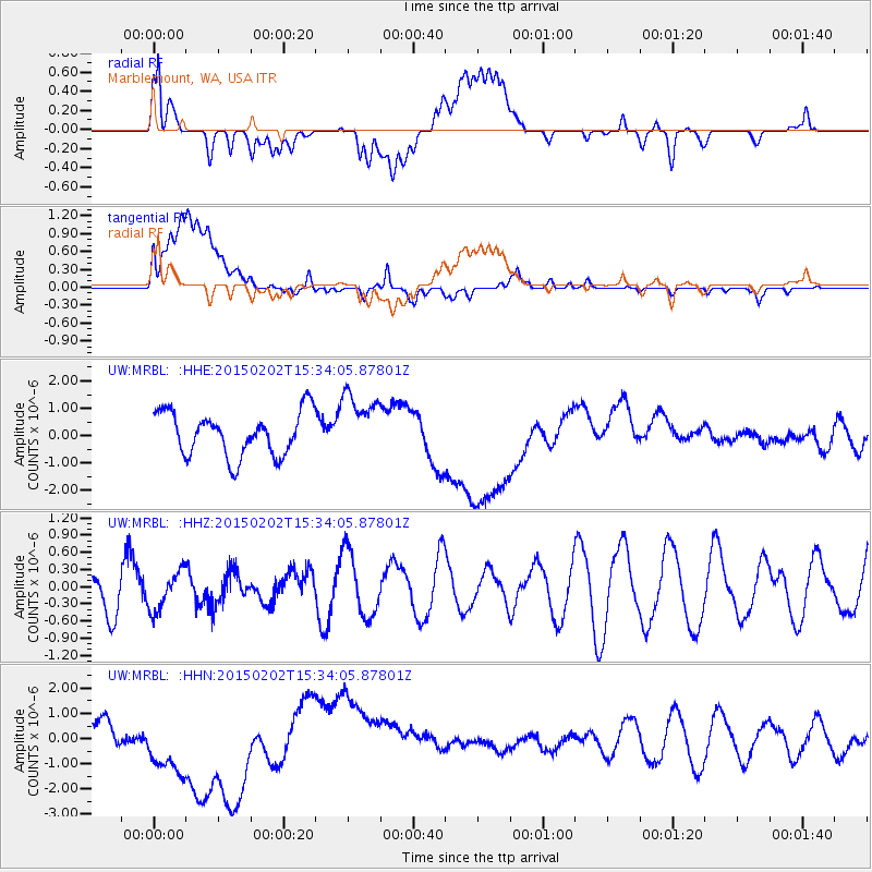
Signal To Noise
| Channel | StoN | STA | LTA |
| UW:MRBL: :HHZ:20150202T15:34:05.87801Z | 0.59571975 | 3.3803425E-7 | 5.6743835E-7 |
| UW:MRBL: :HHN:20150202T15:34:05.87801Z | 4.448204 | 1.7303645E-6 | 3.8900296E-7 |
| UW:MRBL: :HHE:20150202T15:34:05.87801Z | 1.4827757 | 1.1855291E-6 | 7.9953367E-7 |
| Arrivals |
| Ps | |
| PpPs | |
| PsPs/PpSs | |


