You are here: Home > Network List > TA - USArray Transportable Network (new EarthScope stations) Stations List
> Station Q24A Divide, CO, USA > Earthquake Result Viewer
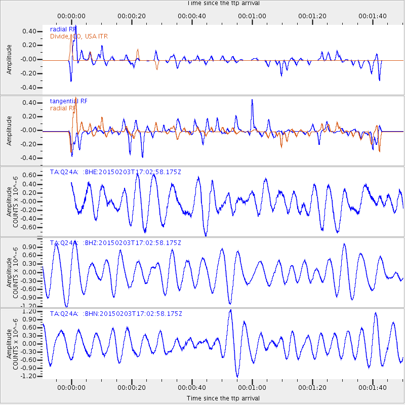
Q24A Divide, CO, USA - Earthquake Result Viewer
*The percent match for this event was below the threshold and hence no stack was calculated.
| Earthquake location: |
South Of Fiji Islands |
| Earthquake latitude/longitude: |
-25.7/-176.1 |
| Earthquake time(UTC): |
2015/02/03 (034) 16:50:19 GMT |
| Earthquake Depth: |
10 km |
| Earthquake Magnitude: |
5.0 MW |
| Earthquake Catalog/Contributor: |
ISC/ISC |
|
| Network: |
TA USArray Transportable Network (new EarthScope stations) |
| Station: |
Q24A Divide, CO, USA |
| Lat/Lon: |
38.96 N/105.15 W |
| Elevation: |
2775 m |
|
| Distance: |
92.3 deg |
| Az: |
47.507 deg |
| Baz: |
238.585 deg |
| Ray Param: |
$rayparam |
*The percent match for this event was below the threshold and hence was not used in the summary stack. |
|
| Radial Match: |
69.26194 % |
| Radial Bump: |
400 |
| Transverse Match: |
57.554134 % |
| Transverse Bump: |
400 |
| SOD ConfigId: |
7019011 |
| Insert Time: |
2019-04-16 15:56:16.429 +0000 |
| GWidth: |
2.5 |
| Max Bumps: |
400 |
| Tol: |
0.001 |
|
Signal To Noise
| Channel | StoN | STA | LTA |
| TA:Q24A: :BHZ:20150203T17:02:58.175Z | 1.7267827 | 7.0218783E-7 | 4.0664517E-7 |
| TA:Q24A: :BHN:20150203T17:02:58.175Z | 1.0807538 | 3.6974325E-7 | 3.4211607E-7 |
| TA:Q24A: :BHE:20150203T17:02:58.175Z | 1.1538775 | 3.470566E-7 | 3.0077425E-7 |
| Arrivals |
| Ps | |
| PpPs | |
| PsPs/PpSs | |


