You are here: Home > Network List > GS - US Geological Survey Networks Stations List
> Station KAN13 Rinehart Farm > Earthquake Result Viewer
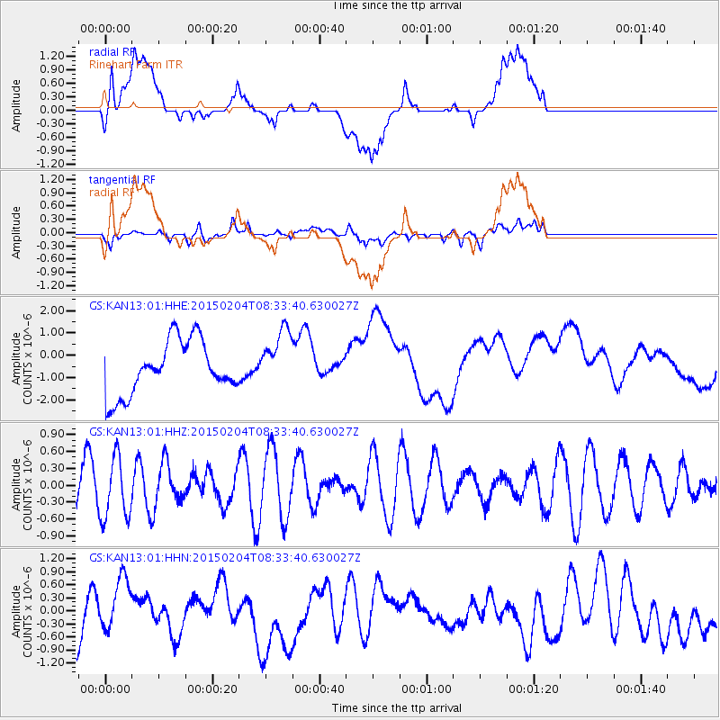
KAN13 Rinehart Farm - Earthquake Result Viewer
*The percent match for this event was below the threshold and hence no stack was calculated.
| Earthquake location: |
South Of Tonga Islands |
| Earthquake latitude/longitude: |
-25.8/-175.9 |
| Earthquake time(UTC): |
2015/02/04 (035) 08:20:45 GMT |
| Earthquake Depth: |
27 km |
| Earthquake Magnitude: |
5.6 MW |
| Earthquake Catalog/Contributor: |
ISC/ISC |
|
| Network: |
GS US Geological Survey Networks |
| Station: |
KAN13 Rinehart Farm |
| Lat/Lon: |
37.01 N/97.48 W |
| Elevation: |
340 m |
|
| Distance: |
96.6 deg |
| Az: |
52.124 deg |
| Baz: |
242.77 deg |
| Ray Param: |
$rayparam |
*The percent match for this event was below the threshold and hence was not used in the summary stack. |
|
| Radial Match: |
28.646454 % |
| Radial Bump: |
400 |
| Transverse Match: |
31.9074 % |
| Transverse Bump: |
400 |
| SOD ConfigId: |
7019011 |
| Insert Time: |
2019-04-16 16:01:22.263 +0000 |
| GWidth: |
2.5 |
| Max Bumps: |
400 |
| Tol: |
0.001 |
|
Signal To Noise
| Channel | StoN | STA | LTA |
| GS:KAN13:01:HHZ:20150204T08:33:40.630027Z | 1.5578836 | 5.526642E-7 | 3.5475318E-7 |
| GS:KAN13:01:HHN:20150204T08:33:40.630027Z | 1.1186782 | 6.940134E-7 | 6.20387E-7 |
| GS:KAN13:01:HHE:20150204T08:33:40.630027Z | 1.1051106 | 1.3267354E-6 | 1.2005453E-6 |
| Arrivals |
| Ps | |
| PpPs | |
| PsPs/PpSs | |


