You are here: Home > Network List > GS - US Geological Survey Networks Stations List
> Station OK031 2598 S. Brethren Rd., Cushing, OK, USA > Earthquake Result Viewer
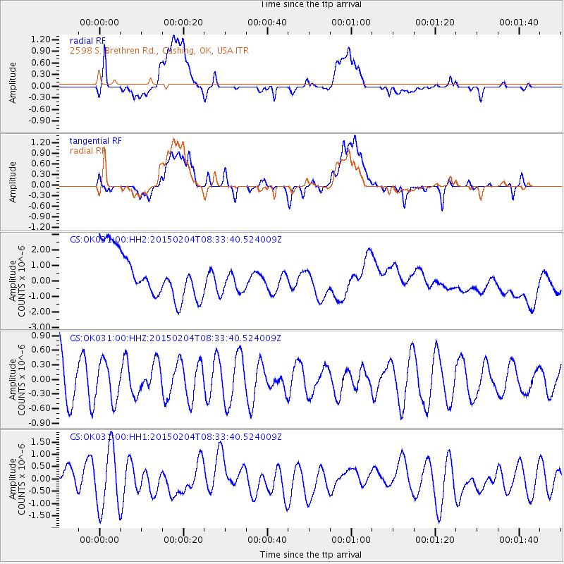
OK031 2598 S. Brethren Rd., Cushing, OK, USA - Earthquake Result Viewer
*The percent match for this event was below the threshold and hence no stack was calculated.
| Earthquake location: |
South Of Tonga Islands |
| Earthquake latitude/longitude: |
-25.8/-175.9 |
| Earthquake time(UTC): |
2015/02/04 (035) 08:20:45 GMT |
| Earthquake Depth: |
27 km |
| Earthquake Magnitude: |
5.6 MW |
| Earthquake Catalog/Contributor: |
ISC/ISC |
|
| Network: |
GS US Geological Survey Networks |
| Station: |
OK031 2598 S. Brethren Rd., Cushing, OK, USA |
| Lat/Lon: |
35.95 N/96.84 W |
| Elevation: |
290 m |
|
| Distance: |
96.5 deg |
| Az: |
53.308 deg |
| Baz: |
243.013 deg |
| Ray Param: |
$rayparam |
*The percent match for this event was below the threshold and hence was not used in the summary stack. |
|
| Radial Match: |
33.06754 % |
| Radial Bump: |
400 |
| Transverse Match: |
33.84748 % |
| Transverse Bump: |
400 |
| SOD ConfigId: |
7019011 |
| Insert Time: |
2019-04-16 16:01:25.819 +0000 |
| GWidth: |
2.5 |
| Max Bumps: |
400 |
| Tol: |
0.001 |
|
Signal To Noise
| Channel | StoN | STA | LTA |
| GS:OK031:00:HHZ:20150204T08:33:40.524009Z | 0.85505694 | 3.9069414E-7 | 4.5692175E-7 |
| GS:OK031:00:HH1:20150204T08:33:40.524009Z | 2.2315364 | 1.2569217E-6 | 5.6325393E-7 |
| GS:OK031:00:HH2:20150204T08:33:40.524009Z | 0.54952276 | 8.013696E-7 | 1.458301E-6 |
| Arrivals |
| Ps | |
| PpPs | |
| PsPs/PpSs | |


