You are here: Home > Network List > TA - USArray Transportable Network (new EarthScope stations) Stations List
> Station 435B Jarrell, TX, USA > Earthquake Result Viewer
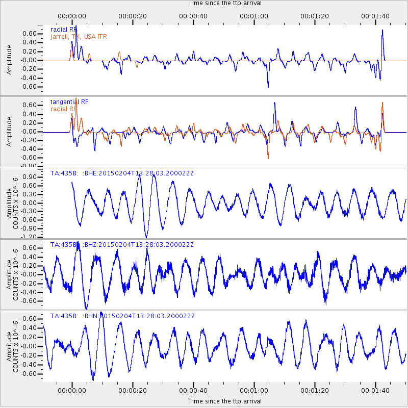
435B Jarrell, TX, USA - Earthquake Result Viewer
*The percent match for this event was below the threshold and hence no stack was calculated.
| Earthquake location: |
South Of Fiji Islands |
| Earthquake latitude/longitude: |
-25.7/-176.2 |
| Earthquake time(UTC): |
2015/02/04 (035) 13:15:20 GMT |
| Earthquake Depth: |
31 km |
| Earthquake Magnitude: |
4.9 MW |
| Earthquake Catalog/Contributor: |
ISC/ISC |
|
| Network: |
TA USArray Transportable Network (new EarthScope stations) |
| Station: |
435B Jarrell, TX, USA |
| Lat/Lon: |
30.78 N/97.58 W |
| Elevation: |
248 m |
|
| Distance: |
93.8 deg |
| Az: |
57.712 deg |
| Baz: |
242.403 deg |
| Ray Param: |
$rayparam |
*The percent match for this event was below the threshold and hence was not used in the summary stack. |
|
| Radial Match: |
53.92343 % |
| Radial Bump: |
354 |
| Transverse Match: |
51.952057 % |
| Transverse Bump: |
395 |
| SOD ConfigId: |
7019011 |
| Insert Time: |
2019-04-16 16:10:28.591 +0000 |
| GWidth: |
2.5 |
| Max Bumps: |
400 |
| Tol: |
0.001 |
|
Signal To Noise
| Channel | StoN | STA | LTA |
| TA:435B: :BHZ:20150204T13:28:03.200022Z | 2.6582606 | 4.7191693E-7 | 1.7752848E-7 |
| TA:435B: :BHN:20150204T13:28:03.200022Z | 0.615993 | 2.1116979E-7 | 3.4281197E-7 |
| TA:435B: :BHE:20150204T13:28:03.200022Z | 1.2528133 | 5.7716517E-7 | 4.6069525E-7 |
| Arrivals |
| Ps | |
| PpPs | |
| PsPs/PpSs | |


