You are here: Home > Network List > TA - USArray Transportable Network (new EarthScope stations) Stations List
> Station I23K Minto, Yukon-Koyukuk, AK, USA > Earthquake Result Viewer
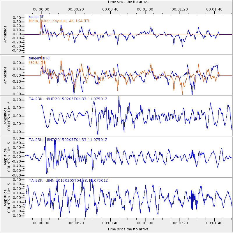
I23K Minto, Yukon-Koyukuk, AK, USA - Earthquake Result Viewer
*The percent match for this event was below the threshold and hence no stack was calculated.
| Earthquake location: |
Venezuela |
| Earthquake latitude/longitude: |
8.3/-72.1 |
| Earthquake time(UTC): |
2015/02/05 (036) 04:21:50 GMT |
| Earthquake Depth: |
22 km |
| Earthquake Magnitude: |
5.3 MW |
| Earthquake Catalog/Contributor: |
ISC/ISC |
|
| Network: |
TA USArray Transportable Network (new EarthScope stations) |
| Station: |
I23K Minto, Yukon-Koyukuk, AK, USA |
| Lat/Lon: |
65.15 N/149.36 W |
| Elevation: |
149 m |
|
| Distance: |
77.2 deg |
| Az: |
334.987 deg |
| Baz: |
98.054 deg |
| Ray Param: |
$rayparam |
*The percent match for this event was below the threshold and hence was not used in the summary stack. |
|
| Radial Match: |
64.80357 % |
| Radial Bump: |
400 |
| Transverse Match: |
54.78219 % |
| Transverse Bump: |
400 |
| SOD ConfigId: |
7019011 |
| Insert Time: |
2019-04-16 16:22:48.371 +0000 |
| GWidth: |
2.5 |
| Max Bumps: |
400 |
| Tol: |
0.001 |
|
Signal To Noise
| Channel | StoN | STA | LTA |
| TA:I23K: :BHZ:20150205T04:33:11.07501Z | 2.3948796 | 3.7071092E-7 | 1.5479314E-7 |
| TA:I23K: :BHN:20150205T04:33:11.07501Z | 0.6704226 | 1.0331676E-7 | 1.541069E-7 |
| TA:I23K: :BHE:20150205T04:33:11.07501Z | 1.9084808 | 2.3228934E-7 | 1.2171427E-7 |
| Arrivals |
| Ps | |
| PpPs | |
| PsPs/PpSs | |


