You are here: Home > Network List > UW - Pacific Northwest Regional Seismic Network Stations List
> Station UMAT Pilot Rock, OR, USA > Earthquake Result Viewer
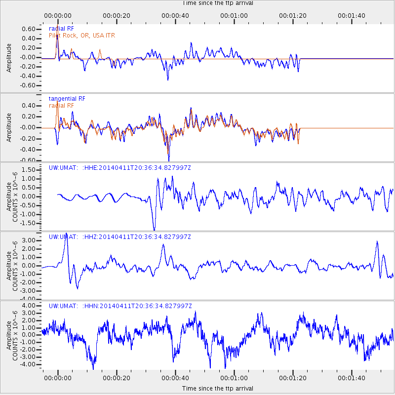
UMAT Pilot Rock, OR, USA - Earthquake Result Viewer
*The percent match for this event was below the threshold and hence no stack was calculated.
| Earthquake location: |
Near Coast Of Nicaragua |
| Earthquake latitude/longitude: |
11.6/-86.0 |
| Earthquake time(UTC): |
2014/04/11 (101) 20:29:13 GMT |
| Earthquake Depth: |
135 km |
| Earthquake Magnitude: |
6.6 MWW, 6.6 MWC, 6.6 MWB, 6.6 MI |
| Earthquake Catalog/Contributor: |
NEIC PDE/NEIC COMCAT |
|
| Network: |
UW Pacific Northwest Regional Seismic Network |
| Station: |
UMAT Pilot Rock, OR, USA |
| Lat/Lon: |
45.29 N/118.96 W |
| Elevation: |
1318 m |
|
| Distance: |
43.8 deg |
| Az: |
326.325 deg |
| Baz: |
129.674 deg |
| Ray Param: |
$rayparam |
*The percent match for this event was below the threshold and hence was not used in the summary stack. |
|
| Radial Match: |
47.497616 % |
| Radial Bump: |
400 |
| Transverse Match: |
47.833332 % |
| Transverse Bump: |
372 |
| SOD ConfigId: |
626651 |
| Insert Time: |
2014-04-25 21:17:47.311 +0000 |
| GWidth: |
2.5 |
| Max Bumps: |
400 |
| Tol: |
0.001 |
|
Signal To Noise
| Channel | StoN | STA | LTA |
| UW:UMAT: :HHZ:20140411T20:36:34.827997Z | 13.407536 | 1.770422E-6 | 1.320468E-7 |
| UW:UMAT: :HHN:20140411T20:36:34.827997Z | 1.2027076 | 1.286038E-6 | 1.0692856E-6 |
| UW:UMAT: :HHE:20140411T20:36:34.827997Z | 5.9379573 | 8.2283384E-7 | 1.3857188E-7 |
| Arrivals |
| Ps | |
| PpPs | |
| PsPs/PpSs | |


