You are here: Home > Network List > TA - USArray Transportable Network (new EarthScope stations) Stations List
> Station R11A Troy Canyon, Currant, NV, USA > Earthquake Result Viewer
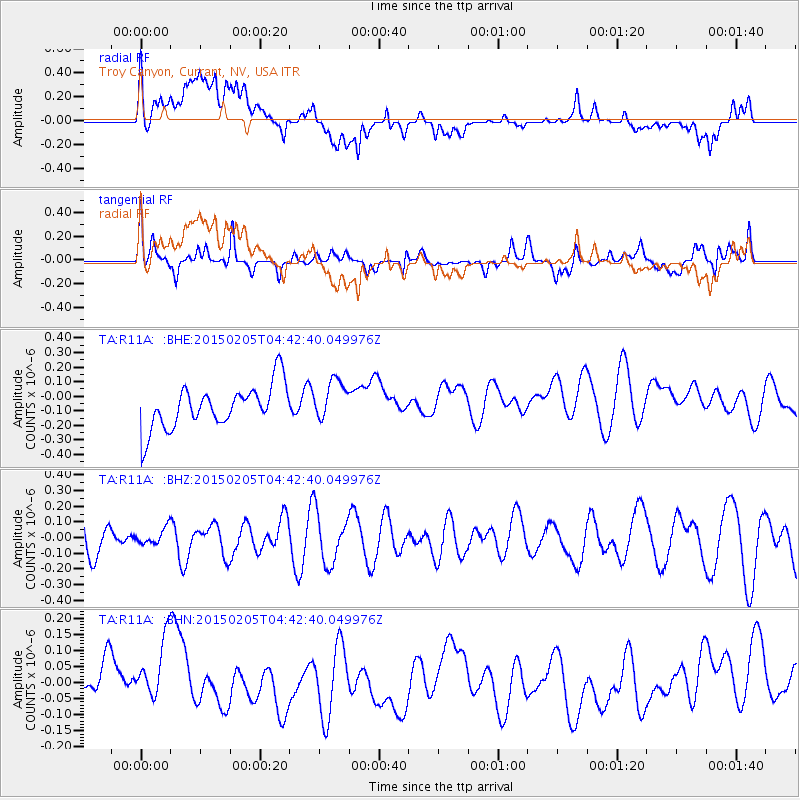
R11A Troy Canyon, Currant, NV, USA - Earthquake Result Viewer
*The percent match for this event was below the threshold and hence no stack was calculated.
| Earthquake location: |
South Of Kermadec Islands |
| Earthquake latitude/longitude: |
-33.3/-178.3 |
| Earthquake time(UTC): |
2015/02/05 (036) 04:30:05 GMT |
| Earthquake Depth: |
35 km |
| Earthquake Magnitude: |
4.7 mb |
| Earthquake Catalog/Contributor: |
ISC/ISC |
|
| Network: |
TA USArray Transportable Network (new EarthScope stations) |
| Station: |
R11A Troy Canyon, Currant, NV, USA |
| Lat/Lon: |
38.35 N/115.59 W |
| Elevation: |
1756 m |
|
| Distance: |
92.0 deg |
| Az: |
44.386 deg |
| Baz: |
228.192 deg |
| Ray Param: |
$rayparam |
*The percent match for this event was below the threshold and hence was not used in the summary stack. |
|
| Radial Match: |
65.890854 % |
| Radial Bump: |
400 |
| Transverse Match: |
63.430496 % |
| Transverse Bump: |
400 |
| SOD ConfigId: |
7019011 |
| Insert Time: |
2019-04-16 16:30:23.504 +0000 |
| GWidth: |
2.5 |
| Max Bumps: |
400 |
| Tol: |
0.001 |
|
Signal To Noise
| Channel | StoN | STA | LTA |
| TA:R11A: :BHZ:20150205T04:42:40.049976Z | 0.39574933 | 5.3651338E-8 | 1.35569E-7 |
| TA:R11A: :BHN:20150205T04:42:40.049976Z | 1.26518 | 1.2457939E-7 | 9.8467716E-8 |
| TA:R11A: :BHE:20150205T04:42:40.049976Z | 0.93832606 | 1.384771E-7 | 1.4757887E-7 |
| Arrivals |
| Ps | |
| PpPs | |
| PsPs/PpSs | |


