You are here: Home > Network List > G - GEOSCOPE Stations List
> Station TAOE Taiohae, Marquises islands > Earthquake Result Viewer
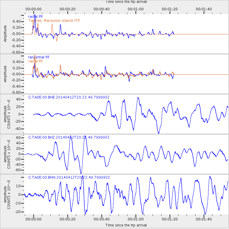
TAOE Taiohae, Marquises islands - Earthquake Result Viewer
*The percent match for this event was below the threshold and hence no stack was calculated.
| Earthquake location: |
Solomon Islands |
| Earthquake latitude/longitude: |
-11.3/162.2 |
| Earthquake time(UTC): |
2014/04/12 (102) 20:14:39 GMT |
| Earthquake Depth: |
29 km |
| Earthquake Magnitude: |
7.6 MWW, 8.3 MI |
| Earthquake Catalog/Contributor: |
NEIC PDE/NEIC COMCAT |
|
| Network: |
G GEOSCOPE |
| Station: |
TAOE Taiohae, Marquises islands |
| Lat/Lon: |
8.85 S/140.15 W |
| Elevation: |
800 m |
|
| Distance: |
56.7 deg |
| Az: |
93.215 deg |
| Baz: |
262.276 deg |
| Ray Param: |
$rayparam |
*The percent match for this event was below the threshold and hence was not used in the summary stack. |
|
| Radial Match: |
91.27979 % |
| Radial Bump: |
316 |
| Transverse Match: |
83.21389 % |
| Transverse Bump: |
321 |
| SOD ConfigId: |
626651 |
| Insert Time: |
2014-04-26 20:42:12.976 +0000 |
| GWidth: |
2.5 |
| Max Bumps: |
400 |
| Tol: |
0.001 |
|
Signal To Noise
| Channel | StoN | STA | LTA |
| G:TAOE:00:BHZ:20140412T20:23:49.799993Z | 2.1454008 | 3.6839197E-6 | 1.7171242E-6 |
| G:TAOE:00:BHN:20140412T20:23:49.799993Z | 0.392168 | 9.535873E-7 | 2.4315787E-6 |
| G:TAOE:00:BHE:20140412T20:23:49.799993Z | 0.91698354 | 2.1985245E-6 | 2.3975617E-6 |
| Arrivals |
| Ps | |
| PpPs | |
| PsPs/PpSs | |


