You are here: Home > Network List > II - Global Seismograph Network (GSN - IRIS/IDA) Stations List
> Station NIL Nilore, Pakistan > Earthquake Result Viewer
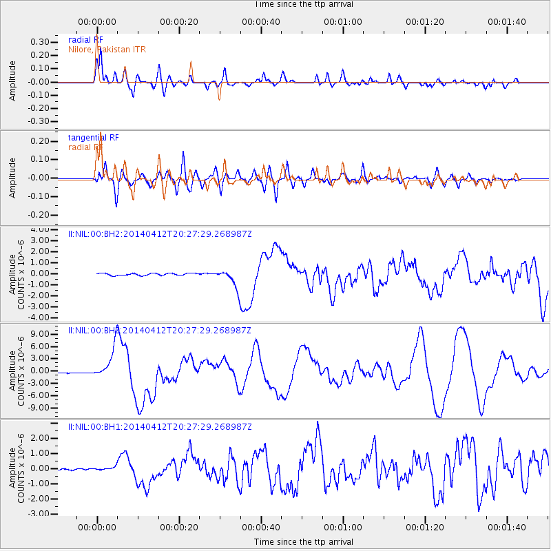
NIL Nilore, Pakistan - Earthquake Result Viewer

| Earthquake location: |
Solomon Islands |
| Earthquake latitude/longitude: |
-11.3/162.2 |
| Earthquake time(UTC): |
2014/04/12 (102) 20:14:39 GMT |
| Earthquake Depth: |
29 km |
| Earthquake Magnitude: |
7.6 MWW, 8.3 MI |
| Earthquake Catalog/Contributor: |
NEIC PDE/NEIC COMCAT |
|
| Network: |
II Global Seismograph Network (GSN - IRIS/IDA) |
| Station: |
NIL Nilore, Pakistan |
| Lat/Lon: |
33.65 N/73.27 E |
| Elevation: |
629 m |
|
| Distance: |
95.3 deg |
| Az: |
303.114 deg |
| Baz: |
99.981 deg |
| Ray Param: |
0.04080619 |
| Estimated Moho Depth: |
15.0 km |
| Estimated Crust Vp/Vs: |
1.88 |
| Assumed Crust Vp: |
6.242 km/s |
| Estimated Crust Vs: |
3.32 km/s |
| Estimated Crust Poisson's Ratio: |
0.30 |
|
| Radial Match: |
92.095184 % |
| Radial Bump: |
400 |
| Transverse Match: |
79.1836 % |
| Transverse Bump: |
400 |
| SOD ConfigId: |
626651 |
| Insert Time: |
2014-04-26 20:43:19.675 +0000 |
| GWidth: |
2.5 |
| Max Bumps: |
400 |
| Tol: |
0.001 |
|
Signal To Noise
| Channel | StoN | STA | LTA |
| II:NIL:00:BHZ:20140412T20:27:29.268987Z | 43.844254 | 4.2840124E-6 | 9.770978E-8 |
| II:NIL:00:BH1:20140412T20:27:29.268987Z | 2.230746 | 1.2692456E-7 | 5.689781E-8 |
| II:NIL:00:BH2:20140412T20:27:29.268987Z | 9.407493 | 9.0080715E-7 | 9.5754224E-8 |
| Arrivals |
| Ps | 2.2 SECOND |
| PpPs | 6.8 SECOND |
| PsPs/PpSs | 9.0 SECOND |


