You are here: Home > Network List > WY - Yellowstone Wyoming Seismic Network Stations List
> Station YHH Holmes Hill, YNP, WY, USA > Earthquake Result Viewer
YHH Holmes Hill, YNP, WY, USA - Earthquake Result Viewer
*The percent match for this event was below the threshold and hence no stack was calculated.
| Earthquake location: |
Near Coast Of Nicaragua |
| Earthquake latitude/longitude: |
12.6/-87.8 |
| Earthquake time(UTC): |
2015/02/06 (037) 22:02:26 GMT |
| Earthquake Depth: |
75 km |
| Earthquake Magnitude: |
5.3 MW |
| Earthquake Catalog/Contributor: |
ISC/ISC |
|
| Network: |
WY Yellowstone Wyoming Seismic Network |
| Station: |
YHH Holmes Hill, YNP, WY, USA |
| Lat/Lon: |
44.79 N/110.85 W |
| Elevation: |
2717 m |
|
| Distance: |
37.7 deg |
| Az: |
332.833 deg |
| Baz: |
141.243 deg |
| Ray Param: |
$rayparam |
*The percent match for this event was below the threshold and hence was not used in the summary stack. |
|
| Radial Match: |
48.162003 % |
| Radial Bump: |
400 |
| Transverse Match: |
49.926266 % |
| Transverse Bump: |
400 |
| SOD ConfigId: |
7019011 |
| Insert Time: |
2019-04-16 16:59:32.291 +0000 |
| GWidth: |
2.5 |
| Max Bumps: |
400 |
| Tol: |
0.001 |
|
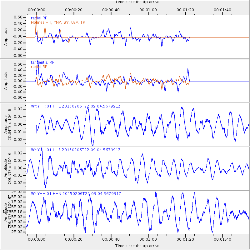
Signal To Noise
| Channel | StoN | STA | LTA |
| WY:YHH:01:HHZ:20150206T22:09:04.567991Z | 4.284704 | 1.522846E-8 | 3.5541452E-9 |
| WY:YHH:01:HHN:20150206T22:09:04.567991Z | 0.84175295 | 8.435626E-9 | 1.0021499E-8 |
| WY:YHH:01:HHE:20150206T22:09:04.567991Z | 2.173628 | 1.6526682E-8 | 7.603271E-9 |
| Arrivals |
| Ps | |
| PpPs | |
| PsPs/PpSs | |


