You are here: Home > Network List > UU - University of Utah Regional Network Stations List
> Station PSUT Pine Spring, UT, USA > Earthquake Result Viewer
PSUT Pine Spring, UT, USA - Earthquake Result Viewer

| Earthquake location: |
Solomon Islands |
| Earthquake latitude/longitude: |
-11.3/162.2 |
| Earthquake time(UTC): |
2014/04/12 (102) 20:14:39 GMT |
| Earthquake Depth: |
29 km |
| Earthquake Magnitude: |
7.6 MWW, 8.3 MI |
| Earthquake Catalog/Contributor: |
NEIC PDE/NEIC COMCAT |
|
| Network: |
UU University of Utah Regional Network |
| Station: |
PSUT Pine Spring, UT, USA |
| Lat/Lon: |
38.53 N/113.85 W |
| Elevation: |
1999 m |
|
| Distance: |
92.3 deg |
| Az: |
51.306 deg |
| Baz: |
257.446 deg |
| Ray Param: |
0.041476272 |
| Estimated Moho Depth: |
38.25 km |
| Estimated Crust Vp/Vs: |
1.60 |
| Assumed Crust Vp: |
6.276 km/s |
| Estimated Crust Vs: |
3.922 km/s |
| Estimated Crust Poisson's Ratio: |
0.18 |
|
| Radial Match: |
93.415115 % |
| Radial Bump: |
400 |
| Transverse Match: |
79.81755 % |
| Transverse Bump: |
400 |
| SOD ConfigId: |
626651 |
| Insert Time: |
2014-04-26 20:51:45.312 +0000 |
| GWidth: |
2.5 |
| Max Bumps: |
400 |
| Tol: |
0.001 |
|
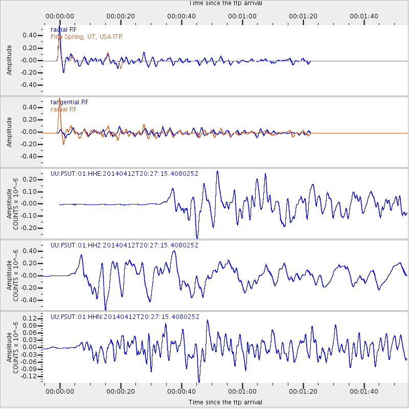
Signal To Noise
| Channel | StoN | STA | LTA |
| UU:PSUT:01:HHZ:20140412T20:27:15.408025Z | 6.688025 | 2.3359165E-8 | 3.492685E-9 |
| UU:PSUT:01:HHN:20140412T20:27:15.408025Z | 0.5372756 | 1.3902253E-9 | 2.5875457E-9 |
| UU:PSUT:01:HHE:20140412T20:27:15.408025Z | 4.64662 | 1.0204674E-8 | 2.19615E-9 |
| Arrivals |
| Ps | 3.7 SECOND |
| PpPs | 16 SECOND |
| PsPs/PpSs | 19 SECOND |


