You are here: Home > Network List > UW - Pacific Northwest Regional Seismic Network Stations List
> Station PASS Maple Falls, WA, USA > Earthquake Result Viewer
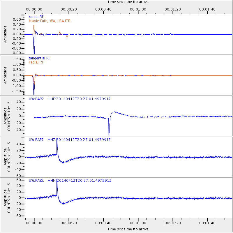
PASS Maple Falls, WA, USA - Earthquake Result Viewer
*The percent match for this event was below the threshold and hence no stack was calculated.
| Earthquake location: |
Solomon Islands |
| Earthquake latitude/longitude: |
-11.3/162.2 |
| Earthquake time(UTC): |
2014/04/12 (102) 20:14:39 GMT |
| Earthquake Depth: |
29 km |
| Earthquake Magnitude: |
7.6 MWW, 8.3 MI |
| Earthquake Catalog/Contributor: |
NEIC PDE/NEIC COMCAT |
|
| Network: |
UW Pacific Northwest Regional Seismic Network |
| Station: |
PASS Maple Falls, WA, USA |
| Lat/Lon: |
49.00 N/122.09 W |
| Elevation: |
174 m |
|
| Distance: |
89.3 deg |
| Az: |
39.661 deg |
| Baz: |
251.9 deg |
| Ray Param: |
$rayparam |
*The percent match for this event was below the threshold and hence was not used in the summary stack. |
|
| Radial Match: |
88.218056 % |
| Radial Bump: |
216 |
| Transverse Match: |
99.685455 % |
| Transverse Bump: |
35 |
| SOD ConfigId: |
626651 |
| Insert Time: |
2014-04-26 20:52:52.144 +0000 |
| GWidth: |
2.5 |
| Max Bumps: |
400 |
| Tol: |
0.001 |
|
Signal To Noise
| Channel | StoN | STA | LTA |
| UW:PASS: :HHZ:20140412T20:27:01.497991Z | 0.81031626 | 1.2751665E-6 | 1.5736651E-6 |
| UW:PASS: :HHN:20140412T20:27:01.497991Z | 0.7707525 | 1.3330524E-6 | 1.7295467E-6 |
| UW:PASS: :HHE:20140412T20:27:01.497991Z | 0.8642586 | 1.2898504E-6 | 1.4924357E-6 |
| Arrivals |
| Ps | |
| PpPs | |
| PsPs/PpSs | |


