You are here: Home > Network List > IU - Global Seismograph Network (GSN - IRIS/USGS) Stations List
> Station POHA Pohakuloa, Hawaii, USA > Earthquake Result Viewer
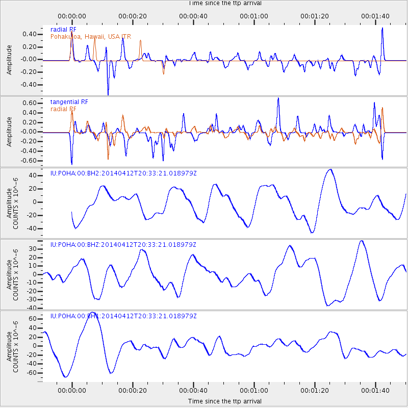
POHA Pohakuloa, Hawaii, USA - Earthquake Result Viewer
*The percent match for this event was below the threshold and hence no stack was calculated.
| Earthquake location: |
Solomon Islands |
| Earthquake latitude/longitude: |
-11.3/162.2 |
| Earthquake time(UTC): |
2014/04/12 (102) 20:24:46 GMT |
| Earthquake Depth: |
27 km |
| Earthquake Magnitude: |
5.9 MB |
| Earthquake Catalog/Contributor: |
NEIC PDE/NEIC COMCAT |
|
| Network: |
IU Global Seismograph Network (GSN - IRIS/USGS) |
| Station: |
POHA Pohakuloa, Hawaii, USA |
| Lat/Lon: |
19.76 N/155.53 W |
| Elevation: |
1990 m |
|
| Distance: |
51.8 deg |
| Az: |
53.721 deg |
| Baz: |
237.094 deg |
| Ray Param: |
$rayparam |
*The percent match for this event was below the threshold and hence was not used in the summary stack. |
|
| Radial Match: |
41.893936 % |
| Radial Bump: |
400 |
| Transverse Match: |
48.98491 % |
| Transverse Bump: |
400 |
| SOD ConfigId: |
626651 |
| Insert Time: |
2014-04-26 21:01:02.218 +0000 |
| GWidth: |
2.5 |
| Max Bumps: |
400 |
| Tol: |
0.001 |
|
Signal To Noise
| Channel | StoN | STA | LTA |
| IU:POHA:00:BHZ:20140412T20:33:21.018979Z | 1.6477511 | 1.2446931E-5 | 7.5538906E-6 |
| IU:POHA:00:BH1:20140412T20:33:21.018979Z | 2.7456331 | 3.704823E-5 | 1.3493511E-5 |
| IU:POHA:00:BH2:20140412T20:33:21.018979Z | 1.0561277 | 1.8260647E-5 | 1.729019E-5 |
| Arrivals |
| Ps | |
| PpPs | |
| PsPs/PpSs | |


