You are here: Home > Network List > PF - Volcanologic Network of Piton de Fournaise-OVPF Stations List
> Station GPS Grandes Pentes Sud > Earthquake Result Viewer
GPS Grandes Pentes Sud - Earthquake Result Viewer
*The percent match for this event was below the threshold and hence no stack was calculated.
| Earthquake location: |
Sulawesi, Indonesia |
| Earthquake latitude/longitude: |
-2.5/119.4 |
| Earthquake time(UTC): |
2015/02/08 (039) 15:09:08 GMT |
| Earthquake Depth: |
30 km |
| Earthquake Magnitude: |
5.5 MW |
| Earthquake Catalog/Contributor: |
ISC/ISC |
|
| Network: |
PF Volcanologic Network of Piton de Fournaise-OVPF |
| Station: |
GPS Grandes Pentes Sud |
| Lat/Lon: |
21.27 S/55.76 E |
| Elevation: |
1004 m |
|
| Distance: |
64.6 deg |
| Az: |
247.728 deg |
| Baz: |
82.403 deg |
| Ray Param: |
$rayparam |
*The percent match for this event was below the threshold and hence was not used in the summary stack. |
|
| Radial Match: |
28.815815 % |
| Radial Bump: |
400 |
| Transverse Match: |
42.10295 % |
| Transverse Bump: |
400 |
| SOD ConfigId: |
7019011 |
| Insert Time: |
2019-04-16 17:06:45.894 +0000 |
| GWidth: |
2.5 |
| Max Bumps: |
400 |
| Tol: |
0.001 |
|
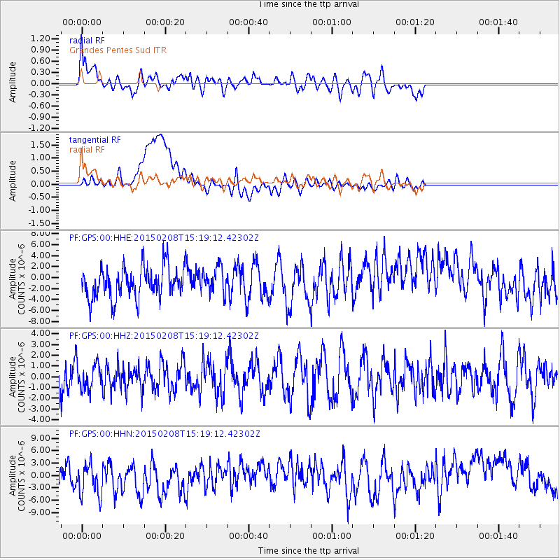
Signal To Noise
| Channel | StoN | STA | LTA |
| PF:GPS:00:HHZ:20150208T15:19:12.42302Z | 0.86680424 | 1.1036749E-6 | 1.2732689E-6 |
| PF:GPS:00:HHN:20150208T15:19:12.42302Z | 1.4041429 | 5.159461E-6 | 3.6744561E-6 |
| PF:GPS:00:HHE:20150208T15:19:12.42302Z | 0.8477142 | 2.3769524E-6 | 2.8039549E-6 |
| Arrivals |
| Ps | |
| PpPs | |
| PsPs/PpSs | |


