You are here: Home > Network List > UW - Pacific Northwest Regional Seismic Network Stations List
> Station PASS Maple Falls, WA, USA > Earthquake Result Viewer
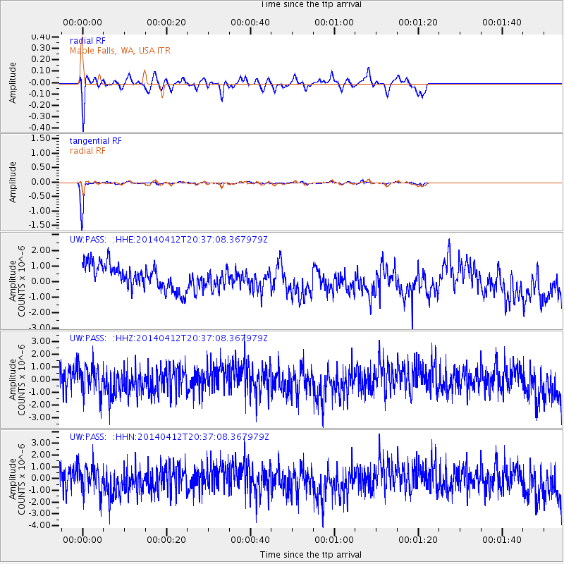
PASS Maple Falls, WA, USA - Earthquake Result Viewer
*The percent match for this event was below the threshold and hence no stack was calculated.
| Earthquake location: |
Solomon Islands |
| Earthquake latitude/longitude: |
-11.3/162.2 |
| Earthquake time(UTC): |
2014/04/12 (102) 20:24:46 GMT |
| Earthquake Depth: |
27 km |
| Earthquake Magnitude: |
5.9 MB |
| Earthquake Catalog/Contributor: |
NEIC PDE/NEIC COMCAT |
|
| Network: |
UW Pacific Northwest Regional Seismic Network |
| Station: |
PASS Maple Falls, WA, USA |
| Lat/Lon: |
49.00 N/122.09 W |
| Elevation: |
174 m |
|
| Distance: |
89.3 deg |
| Az: |
39.668 deg |
| Baz: |
251.939 deg |
| Ray Param: |
$rayparam |
*The percent match for this event was below the threshold and hence was not used in the summary stack. |
|
| Radial Match: |
41.067177 % |
| Radial Bump: |
400 |
| Transverse Match: |
97.14598 % |
| Transverse Bump: |
129 |
| SOD ConfigId: |
626651 |
| Insert Time: |
2014-04-26 21:05:23.269 +0000 |
| GWidth: |
2.5 |
| Max Bumps: |
400 |
| Tol: |
0.001 |
|
Signal To Noise
| Channel | StoN | STA | LTA |
| UW:PASS: :HHZ:20140412T20:37:08.367979Z | 1.2358518 | 1.2717713E-6 | 1.0290646E-6 |
| UW:PASS: :HHN:20140412T20:37:08.367979Z | 1.1571426 | 1.3115471E-6 | 1.133436E-6 |
| UW:PASS: :HHE:20140412T20:37:08.367979Z | 0.741982 | 5.8859945E-7 | 7.9328E-7 |
| Arrivals |
| Ps | |
| PpPs | |
| PsPs/PpSs | |


