KDAK Kodiak Island, Alaska, USA - Earthquake Result Viewer
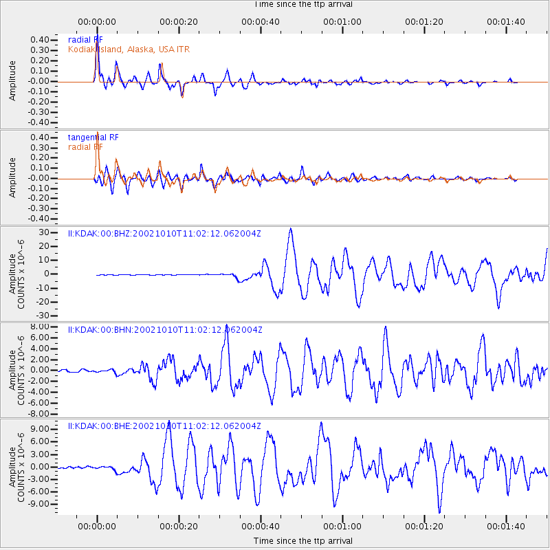
Earthquake location: Irian Jaya Region, Indonesia
Earthquake latitude/longitude: -1.8/134.3
Earthquake time(UTC): 2002/10/10 (283) 10:50:20 GMT
Earthquake Depth: 10 km
Earthquake Magnitude: 6.5 MB, 7.7 MS, 7.6 MW, 7.4 MW
Earthquake Catalog/Contributor: WHDF/NEIC
Network: II Global Seismograph Network (GSN - IRIS/IDA)
Station: KDAK Kodiak Island, Alaska, USA
Lat/Lon: 57.78 N/152.58 W
Elevation: 152 m
Distance: 82.5 deg
Az: 31.13 deg
Baz: 254.715 deg
Ray Param: 0.046813745
Estimated Moho Depth: 32.75 km
Estimated Crust Vp/Vs: 1.98
Assumed Crust Vp: 6.134 km/s
Estimated Crust Vs: 3.106 km/s
Estimated Crust Poisson's Ratio: 0.33
Radial Match: 96.83848 %
Radial Bump: 356
Transverse Match: 92.66231 %
Transverse Bump: 400
SOD ConfigId: 4714
Insert Time: 2010-03-01 20:56:17.295 +0000
GWidth: 2.5
Max Bumps: 400
Tol: 0.001

Signal To Noise

ChannelStoNSTALTA
II:KDAK:00:BHN:20021010T11:02:12.062004Z0.955856562.8651826E-72.9975027E-7
II:KDAK:00:BHE:20021010T11:02:12.062004Z1.517584.3650246E-72.876306E-7
II:KDAK:00:BHZ:20021010T11:02:12.062004Z8.54427051.6370686E-61.915984E-7
Arrivals
Ps5.3 SECOND
PpPs16 SECOND
PsPs/PpSs21 SECOND