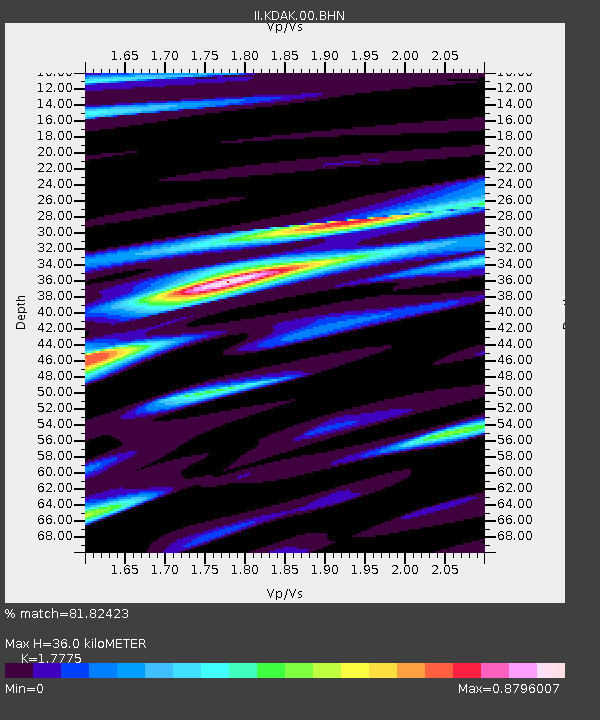
KDAK Kodiak Island, Alaska, USA - Earthquake Result Viewer

Earthquake location: New Britain Region, P.N.G.
Earthquake latitude/longitude: -5.1/152.5
Earthquake time(UTC): 2003/06/07 (158) 00:32:45 GMT
Earthquake Depth: 33 km
Earthquake Magnitude: 6.0 MB, 6.8 MS, 6.6 MW, 6.5 MW
Earthquake Catalog/Contributor: WHDF/NEIC
Network: II Global Seismograph Network (GSN - IRIS/IDA)
Station: KDAK Kodiak Island, Alaska, USA
Lat/Lon: 57.78 N/152.58 W
Elevation: 152 m
Distance: 76.6 deg
Az: 26.787 deg
Baz: 236.931 deg
Ray Param: 0.050857767
Estimated Moho Depth: 36.0 km
Estimated Crust Vp/Vs: 1.78
Assumed Crust Vp: 6.134 km/s
Estimated Crust Vs: 3.451 km/s
Estimated Crust Poisson's Ratio: 0.27
Radial Match: 81.82423 %
Radial Bump: 330
Transverse Match: 63.427864 %
Transverse Bump: 400
SOD ConfigId: 4714
Insert Time: 2010-03-01 20:56:34.656 +0000
GWidth: 2.5
Max Bumps: 400
Tol: 0.001

Signal To Noise

ChannelStoNSTALTA
II:KDAK:00:BHN:20030607T00:44:01.600029Z2.96370638.2538253E-72.7849674E-7
II:KDAK:00:BHE:20030607T00:44:01.600029Z2.52144078.958479E-73.552921E-7
II:KDAK:00:BHZ:20030607T00:44:01.600029Z12.4212052.775843E-62.2347615E-7
Arrivals
Ps4.7 SECOND
PpPs16 SECOND
PsPs/PpSs21 SECOND