KDAK Kodiak Island, Alaska, USA - Earthquake Result Viewer
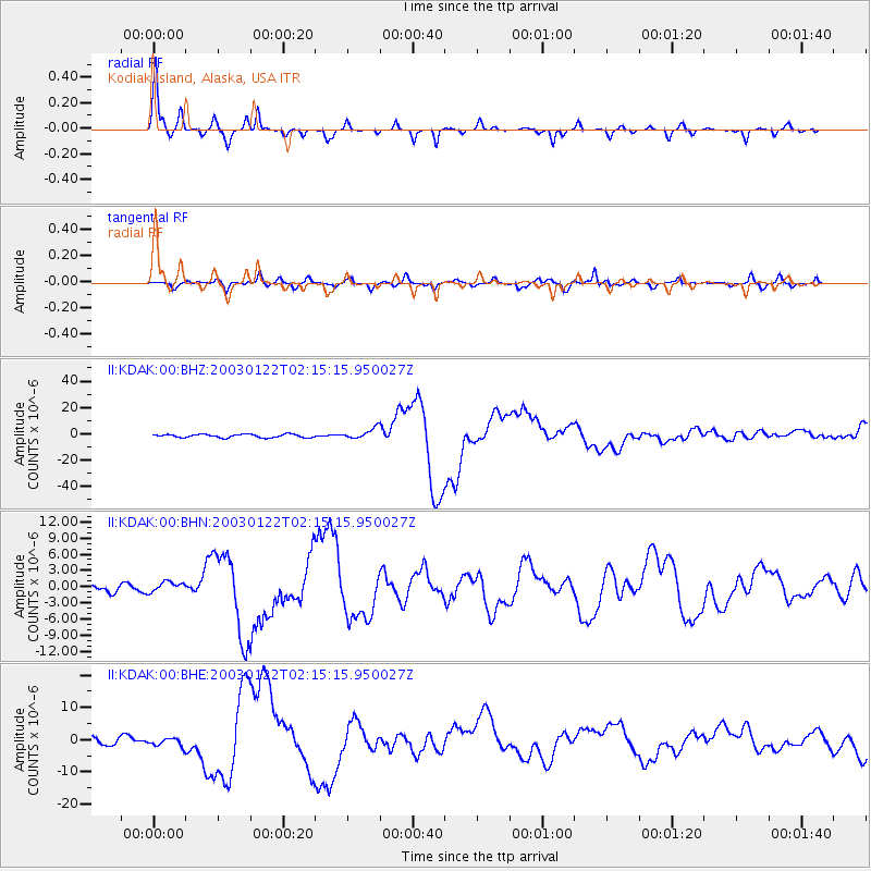
Earthquake location: Near Coast Of Jalisco, Mexico
Earthquake latitude/longitude: 18.8/-104.1
Earthquake time(UTC): 2003/01/22 (022) 02:06:34 GMT
Earthquake Depth: 24 km
Earthquake Magnitude: 6.5 MB, 7.6 MS, 7.6 MW, 7.4 MW
Earthquake Catalog/Contributor: WHDF/NEIC
Network: II Global Seismograph Network (GSN - IRIS/IDA)
Station: KDAK Kodiak Island, Alaska, USA
Lat/Lon: 57.78 N/152.58 W
Elevation: 152 m
Distance: 52.7 deg
Az: 329.704 deg
Baz: 116.843 deg
Ray Param: 0.066581324
Estimated Moho Depth: 40.0 km
Estimated Crust Vp/Vs: 1.62
Assumed Crust Vp: 6.134 km/s
Estimated Crust Vs: 3.792 km/s
Estimated Crust Poisson's Ratio: 0.19
Radial Match: 96.83521 %
Radial Bump: 312
Transverse Match: 80.72379 %
Transverse Bump: 400
SOD ConfigId: 4714
Insert Time: 2010-03-01 20:57:25.027 +0000
GWidth: 2.5
Max Bumps: 400
Tol: 0.001

Signal To Noise

ChannelStoNSTALTA
II:KDAK:00:BHN:20030122T02:15:15.950027Z1.10511429.823718E-78.8893245E-7
II:KDAK:00:BHE:20030122T02:15:15.950027Z1.23351181.368277E-61.1092533E-6
II:KDAK:00:BHZ:20030122T02:15:15.950027Z3.1104823.925523E-61.2620304E-6
Arrivals
Ps4.3 SECOND
PpPs16 SECOND
PsPs/PpSs20 SECOND