KDAK Kodiak Island, Alaska, USA - Earthquake Result Viewer
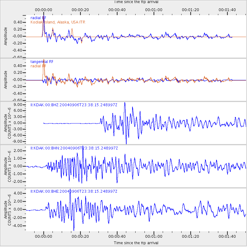
Earthquake location: Near S. Coast Of Honshu, Japan
Earthquake latitude/longitude: 33.2/137.2
Earthquake time(UTC): 2004/09/06 (250) 23:29:35 GMT
Earthquake Depth: 10 km
Earthquake Magnitude: 6.4 MB, 6.3 MS, 6.7 MW, 6.5 MW
Earthquake Catalog/Contributor: WHDF/NEIC
Network: II Global Seismograph Network (GSN - IRIS/IDA)
Station: KDAK Kodiak Island, Alaska, USA
Lat/Lon: 57.78 N/152.58 W
Elevation: 152 m
Distance: 52.2 deg
Az: 39.61 deg
Baz: 273.776 deg
Ray Param: 0.066891424
Estimated Moho Depth: 29.75 km
Estimated Crust Vp/Vs: 1.96
Assumed Crust Vp: 6.134 km/s
Estimated Crust Vs: 3.138 km/s
Estimated Crust Poisson's Ratio: 0.32
Radial Match: 93.39058 %
Radial Bump: 400
Transverse Match: 82.85571 %
Transverse Bump: 400
SOD ConfigId: 2459
Insert Time: 2010-03-01 20:57:35.632 +0000
GWidth: 2.5
Max Bumps: 400
Tol: 0.001

Signal To Noise

ChannelStoNSTALTA
II:KDAK:00:BHN:20040906T23:38:15.248997Z5.5978952.3772472E-74.2466805E-8
II:KDAK:00:BHE:20040906T23:38:15.248997Z11.043747.823193E-77.083826E-8
II:KDAK:00:BHZ:20040906T23:38:15.248997Z25.4728551.7756445E-66.9707326E-8
Arrivals
Ps4.8 SECOND
PpPs14 SECOND
PsPs/PpSs19 SECOND