KDAK Kodiak Island, Alaska, USA - Earthquake Result Viewer
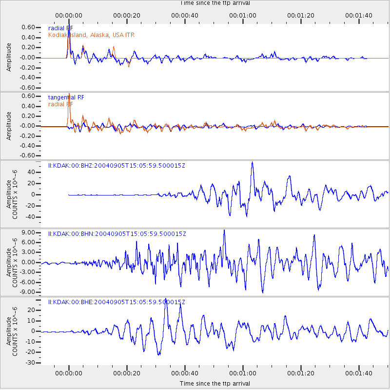
Earthquake location: Near S. Coast Of Honshu, Japan
Earthquake latitude/longitude: 33.2/137.1
Earthquake time(UTC): 2004/09/05 (249) 14:57:18 GMT
Earthquake Depth: 10 km
Earthquake Magnitude: 6.2 MB, 7.1 MS, 7.4 MW, 7.4 MW
Earthquake Catalog/Contributor: WHDF/NEIC
Network: II Global Seismograph Network (GSN - IRIS/IDA)
Station: KDAK Kodiak Island, Alaska, USA
Lat/Lon: 57.78 N/152.58 W
Elevation: 152 m
Distance: 52.3 deg
Az: 39.593 deg
Baz: 273.886 deg
Ray Param: 0.06682775
Estimated Moho Depth: 30.25 km
Estimated Crust Vp/Vs: 1.95
Assumed Crust Vp: 6.134 km/s
Estimated Crust Vs: 3.154 km/s
Estimated Crust Poisson's Ratio: 0.32
Radial Match: 97.308235 %
Radial Bump: 366
Transverse Match: 89.38966 %
Transverse Bump: 400
SOD ConfigId: 2459
Insert Time: 2010-03-01 20:57:41.012 +0000
GWidth: 2.5
Max Bumps: 400
Tol: 0.001

Signal To Noise

ChannelStoNSTALTA
II:KDAK:00:BHN:20040905T15:05:59.500015Z1.18136571.7568622E-71.487145E-7
II:KDAK:00:BHE:20040905T15:05:59.500015Z2.75550996.219348E-72.2570589E-7
II:KDAK:00:BHZ:20040905T15:05:59.500015Z10.2371251.5854065E-61.5486833E-7
Arrivals
Ps4.9 SECOND
PpPs14 SECOND
PsPs/PpSs19 SECOND