You are here: Home > Network List > CI - Caltech Regional Seismic Network Stations List
> Station MPM Manuel Prospect Mine, California, USA > Earthquake Result Viewer
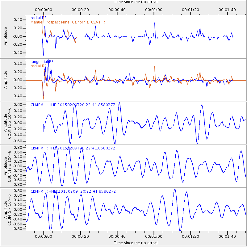
MPM Manuel Prospect Mine, California, USA - Earthquake Result Viewer
*The percent match for this event was below the threshold and hence no stack was calculated.
| Earthquake location: |
Kuril Islands |
| Earthquake latitude/longitude: |
44.0/146.9 |
| Earthquake time(UTC): |
2015/02/09 (040) 20:12:13 GMT |
| Earthquake Depth: |
89 km |
| Earthquake Magnitude: |
4.9 mb |
| Earthquake Catalog/Contributor: |
ISC/ISC |
|
| Network: |
CI Caltech Regional Seismic Network |
| Station: |
MPM Manuel Prospect Mine, California, USA |
| Lat/Lon: |
36.06 N/117.49 W |
| Elevation: |
185 m |
|
| Distance: |
69.6 deg |
| Az: |
59.362 deg |
| Baz: |
309.979 deg |
| Ray Param: |
$rayparam |
*The percent match for this event was below the threshold and hence was not used in the summary stack. |
|
| Radial Match: |
66.979126 % |
| Radial Bump: |
400 |
| Transverse Match: |
75.11214 % |
| Transverse Bump: |
400 |
| SOD ConfigId: |
7019011 |
| Insert Time: |
2019-04-16 17:28:09.452 +0000 |
| GWidth: |
2.5 |
| Max Bumps: |
400 |
| Tol: |
0.001 |
|
Signal To Noise
| Channel | StoN | STA | LTA |
| CI:MPM: :HHZ:20150209T20:22:41.858027Z | 1.2378436 | 4.572927E-7 | 3.6942689E-7 |
| CI:MPM: :HHN:20150209T20:22:41.858027Z | 1.7186875 | 5.488515E-7 | 3.193434E-7 |
| CI:MPM: :HHE:20150209T20:22:41.858027Z | 0.7378969 | 2.1115707E-7 | 2.8616068E-7 |
| Arrivals |
| Ps | |
| PpPs | |
| PsPs/PpSs | |


