
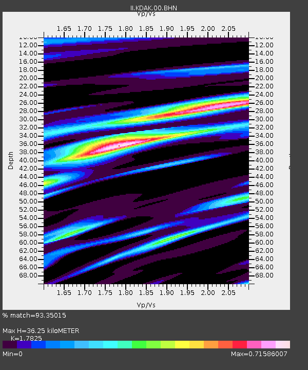
KDAK Kodiak Island, Alaska, USA - Earthquake Result Viewer
| ||||||||||||||||||
| ||||||||||||||||||
| ||||||||||||||||||
|
Signal To Noise
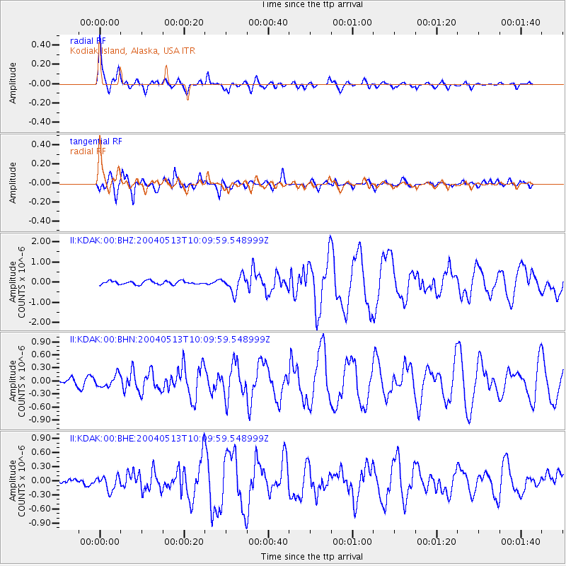
| Channel | StoN | STA | LTA |
| II:KDAK:00:BHN:20040513T10:09:59.548999Z | 1.6894813 | 1.3974679E-7 | 8.271579E-8 |
| II:KDAK:00:BHE:20040513T10:09:59.548999Z | 1.0386089 | 1.5283801E-7 | 1.4715646E-7 |
| II:KDAK:00:BHZ:20040513T10:09:59.548999Z | 4.9386477 | 4.176155E-7 | 8.4560696E-8 |
| Arrivals | |
| Ps | 4.8 SECOND |
| PpPs | 16 SECOND |
| PsPs/PpSs | 21 SECOND |

