You are here: Home > Network List > CN - Canadian National Seismograph Network Stations List
> Station INK INUVIK, NT > Earthquake Result Viewer
INK INUVIK, NT - Earthquake Result Viewer
*The percent match for this event was below the threshold and hence no stack was calculated.
| Earthquake location: |
Philippine Islands Region |
| Earthquake latitude/longitude: |
11.3/126.2 |
| Earthquake time(UTC): |
2015/02/10 (041) 13:29:44 GMT |
| Earthquake Depth: |
49 km |
| Earthquake Magnitude: |
5.4 MW |
| Earthquake Catalog/Contributor: |
ISC/ISC |
|
| Network: |
CN Canadian National Seismograph Network |
| Station: |
INK INUVIK, NT |
| Lat/Lon: |
68.31 N/133.53 W |
| Elevation: |
44 m |
|
| Distance: |
83.4 deg |
| Az: |
21.613 deg |
| Baz: |
283.619 deg |
| Ray Param: |
$rayparam |
*The percent match for this event was below the threshold and hence was not used in the summary stack. |
|
| Radial Match: |
60.55557 % |
| Radial Bump: |
333 |
| Transverse Match: |
55.68039 % |
| Transverse Bump: |
400 |
| SOD ConfigId: |
7019011 |
| Insert Time: |
2019-04-16 17:37:43.948 +0000 |
| GWidth: |
2.5 |
| Max Bumps: |
400 |
| Tol: |
0.001 |
|
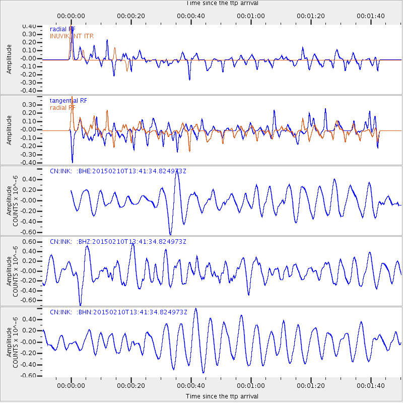
Signal To Noise
| Channel | StoN | STA | LTA |
| CN:INK: :BHZ:20150210T13:41:34.824973Z | 2.0247712 | 3.0294973E-7 | 1.4962171E-7 |
| CN:INK: :BHN:20150210T13:41:34.824973Z | 0.687394 | 7.083007E-8 | 1.0304144E-7 |
| CN:INK: :BHE:20150210T13:41:34.824973Z | 2.6382444 | 3.1614542E-7 | 1.1983174E-7 |
| Arrivals |
| Ps | |
| PpPs | |
| PsPs/PpSs | |


